Weather & Forecasts
Current Conditions
Forecasts
Satellite Imagery
Radar Imagery
Winter Wx
Fire Weather
Long Range Outlooks
Other
Kentucky Climate
Climatology
Pests/Disease
Ag/Wx Calculators
Hydrology Info.
Other UKAWC Sites
Severe Wx
Tropical Wx
Kentucky Ag Wx
Drought
National Wx
International Wx
Learning About Wx
About UKAWC
UKAWC Home
 |
Kentucky and National Drought Information |
Home| Current Conditions| Forecasts| Satellite| Radar| Media| Outlooks| Drought| Severe| Tropical Wx| Winter Wx| Climatology| Calc| Fire| NWS| Historical| About Us| Spring & Fall Ag-Update| Glance| GlanceClim
|
Precipitation | Historical Info. | State & National Info. Outlooks | River Forecasts |
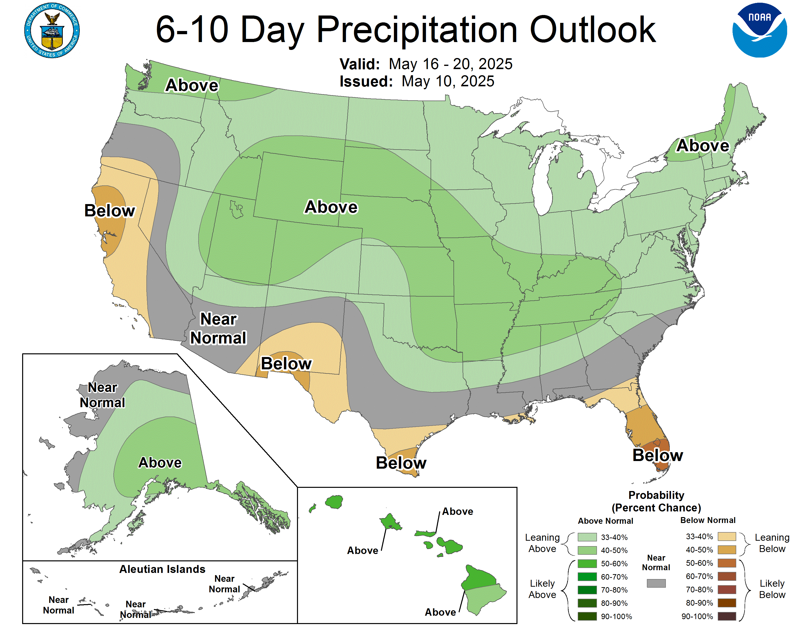
![]() Drought Status for Kentucky (Updated Monday @ 4PM),
Outlook
Drought Status for Kentucky (Updated Monday @ 4PM),
Outlook
![]() NWS Drought Statements:
West (No statement available),
Central (No statement available),
East (No statement available)
NWS Drought Statements:
West (No statement available),
Central (No statement available),
East (No statement available)
![]() Click here
for the Kentucky Climate Webcast. (Not Currently Available - Updated on Monday @ Noon)
Click here
for the Kentucky Climate Webcast. (Not Currently Available - Updated on Monday @ Noon)
 PDSI Map (Updated on Mon. Eve) |
 Crop Moisture Map (Updated on Mon. Eve.) |
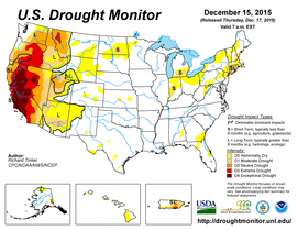
 Drought Monitor (Updated on Thur. ) |
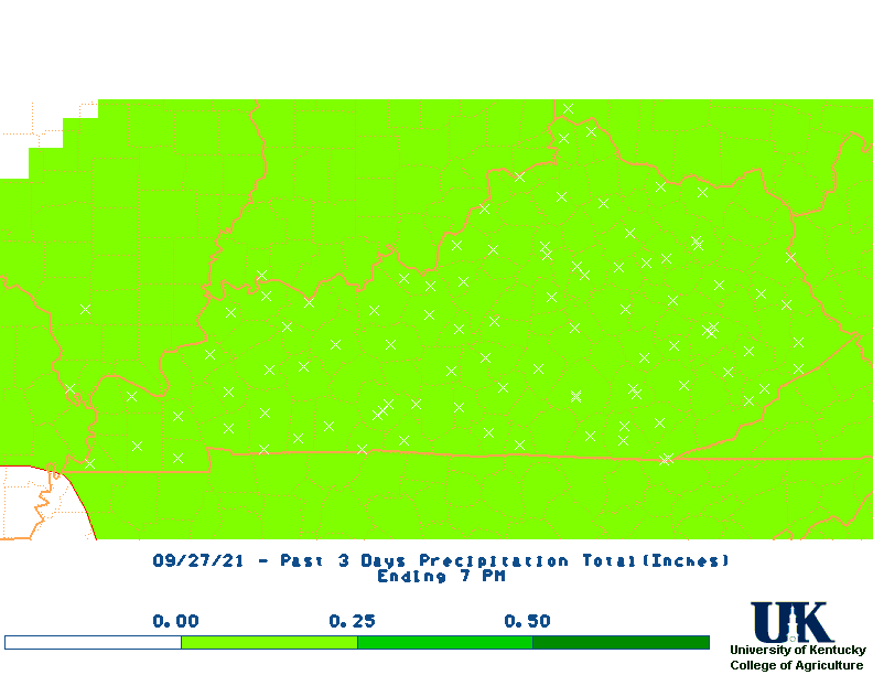
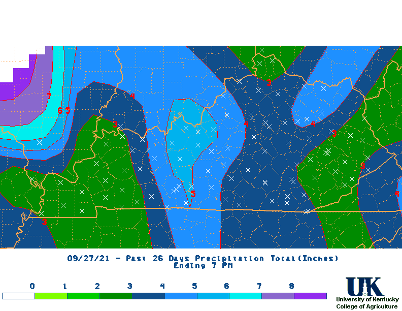
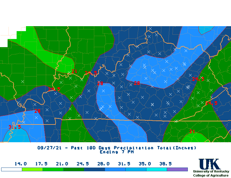
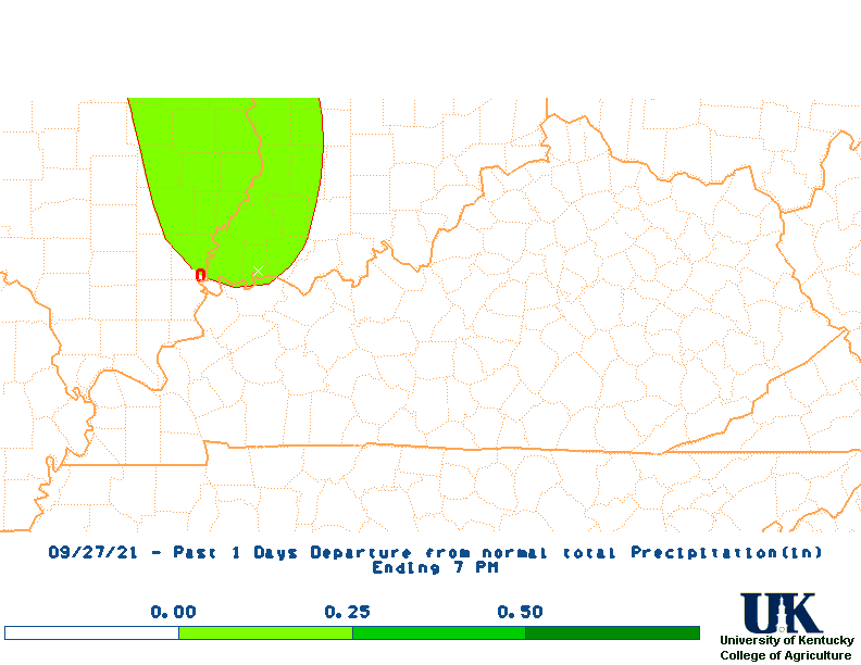
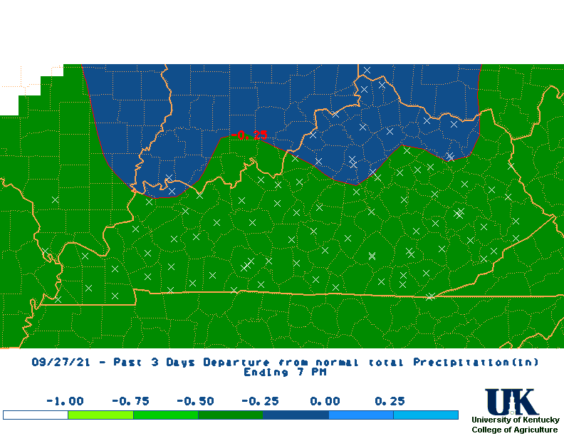
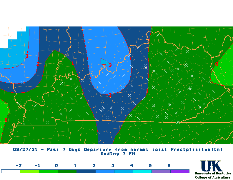
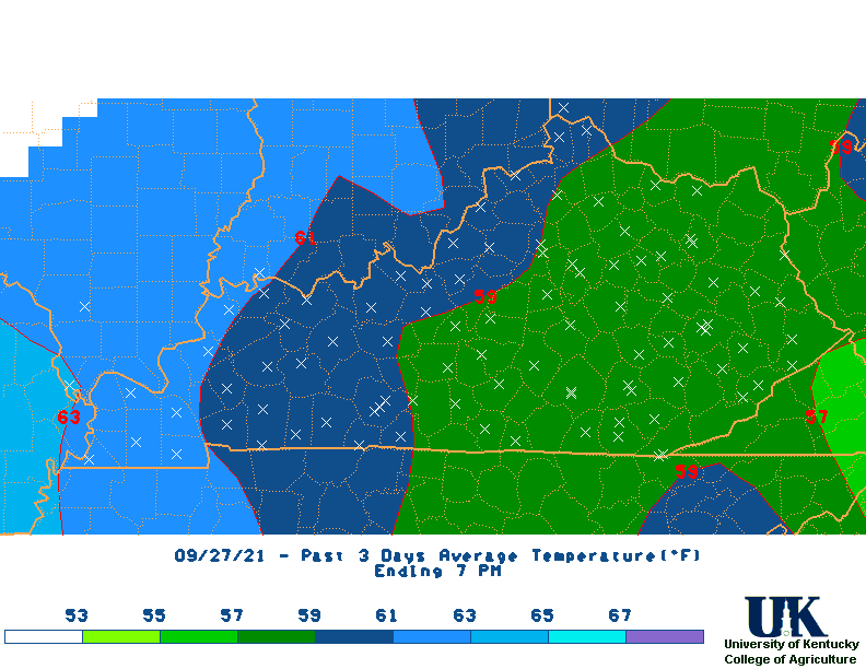
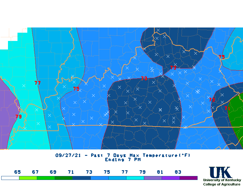
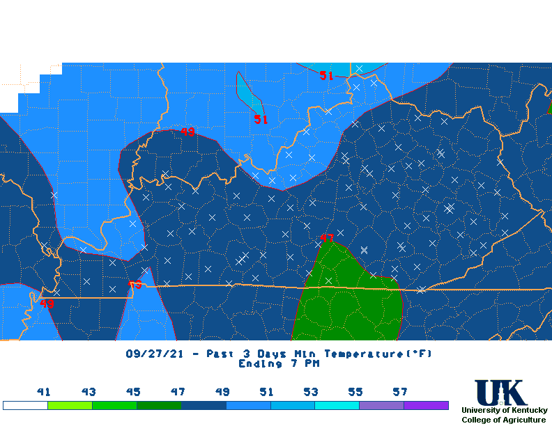
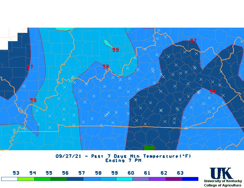
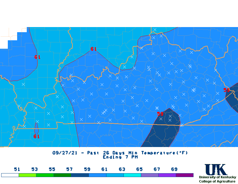
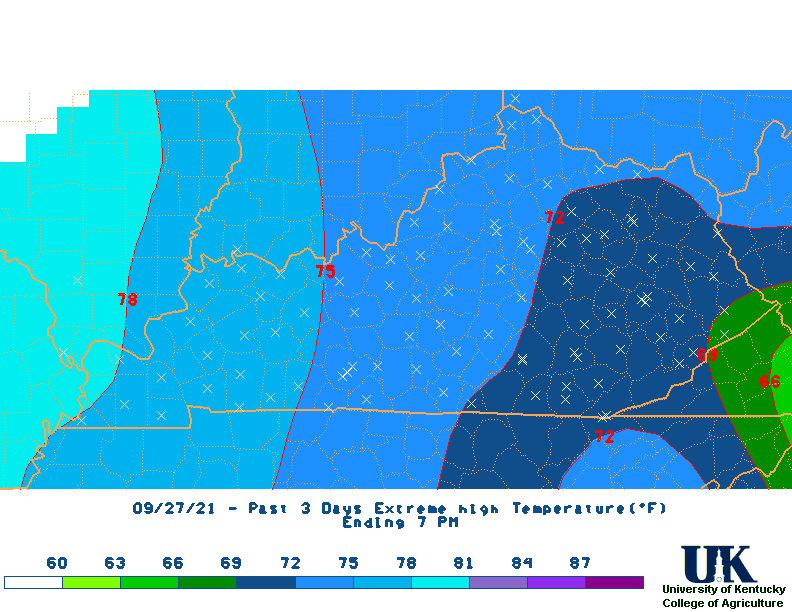
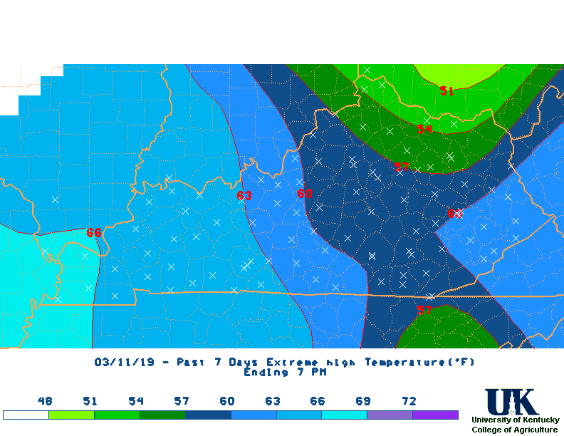
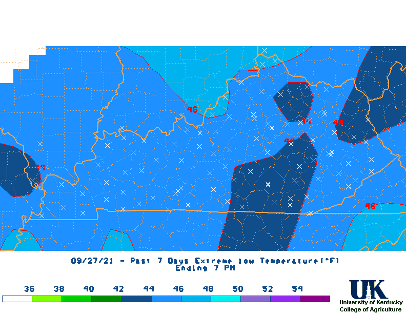
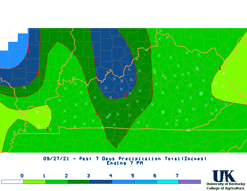 Last 7-day Rainfall Totals Map (Updated daily at 10am) |
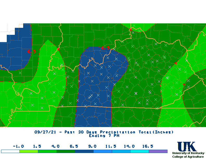
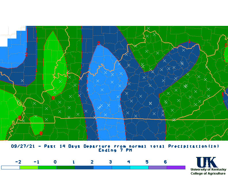
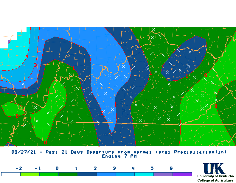
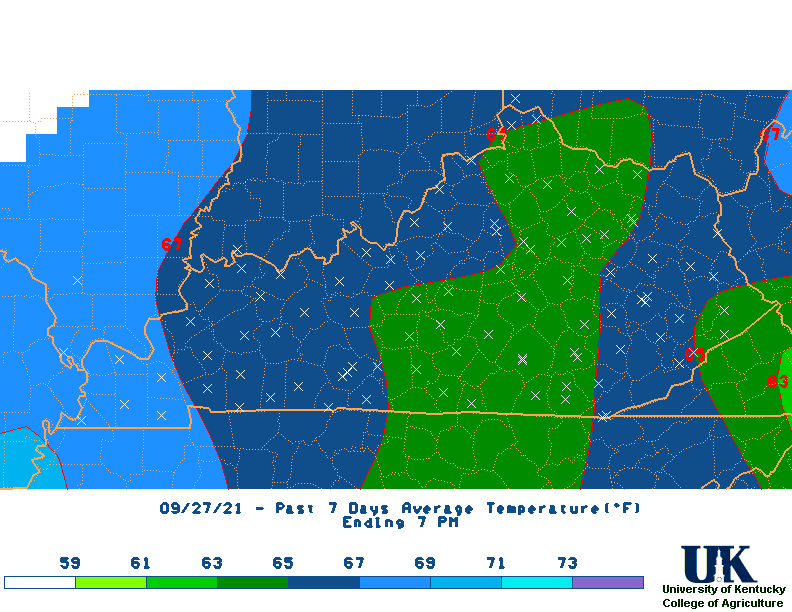
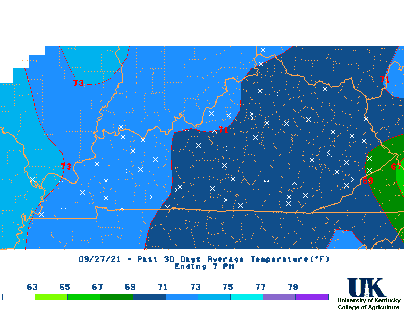
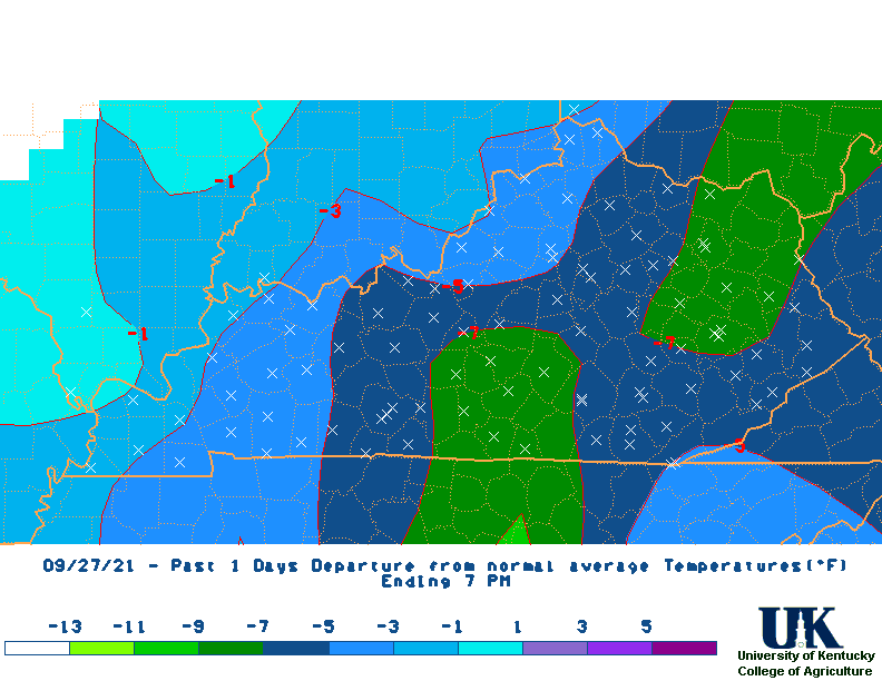
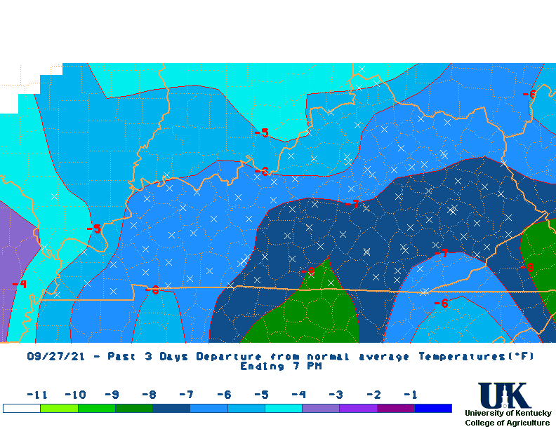
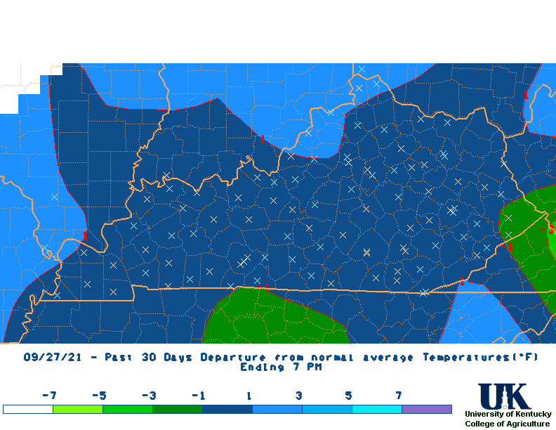
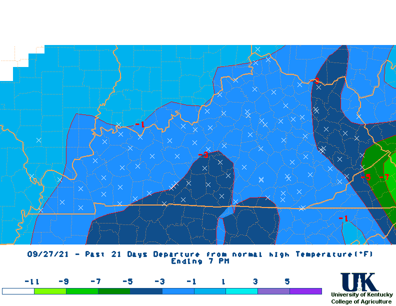
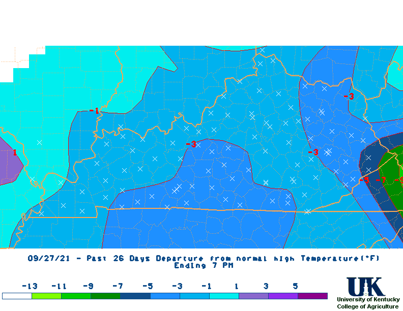
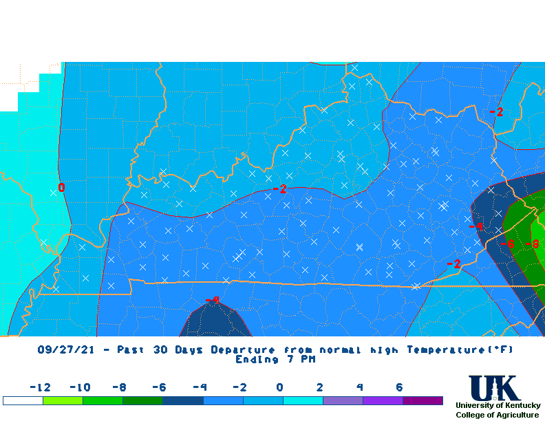
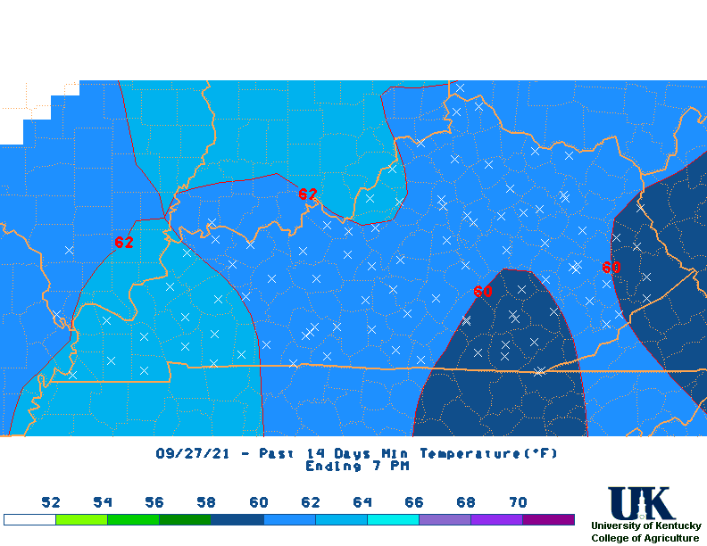
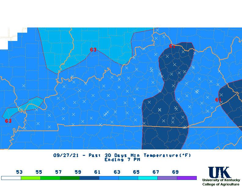
 Last 30-day Rainfall Departures Map (Updated daily at 10am) |
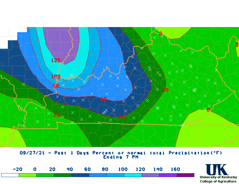
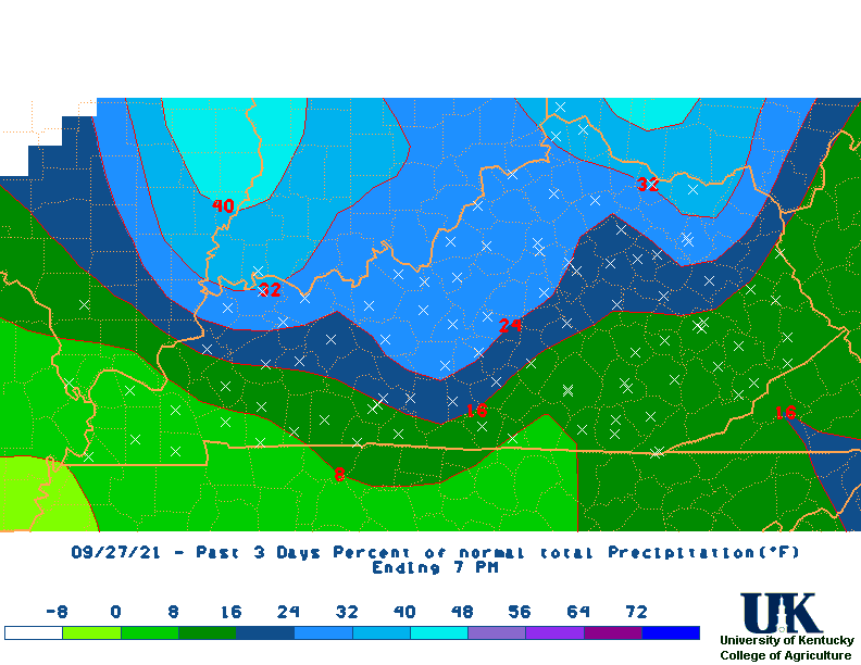
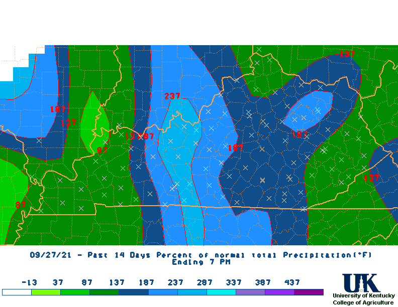
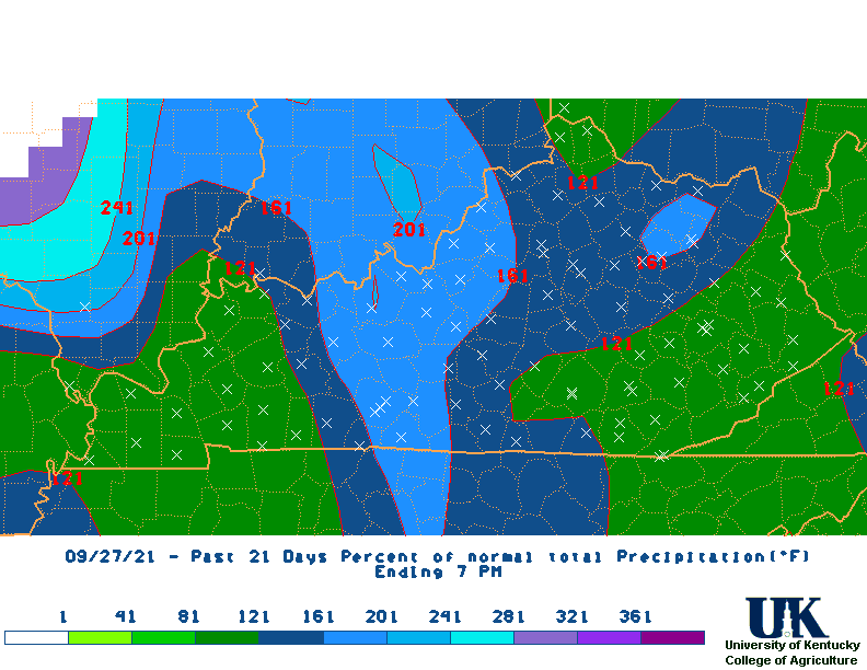
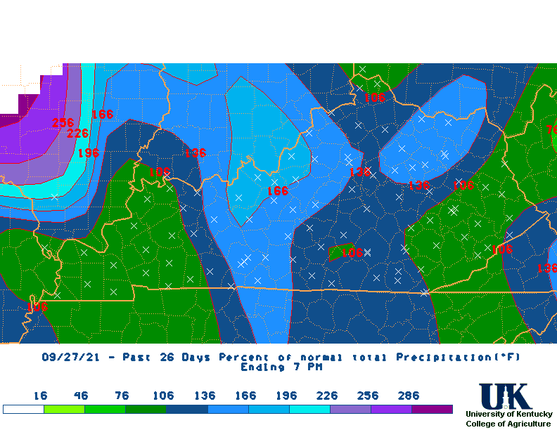
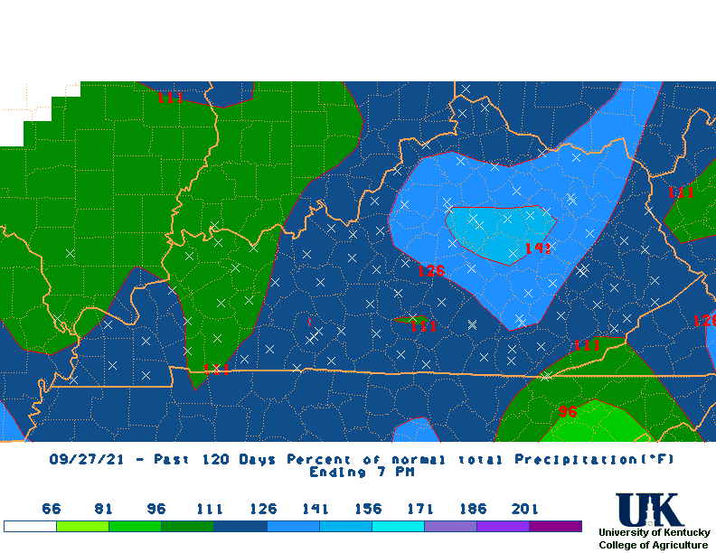
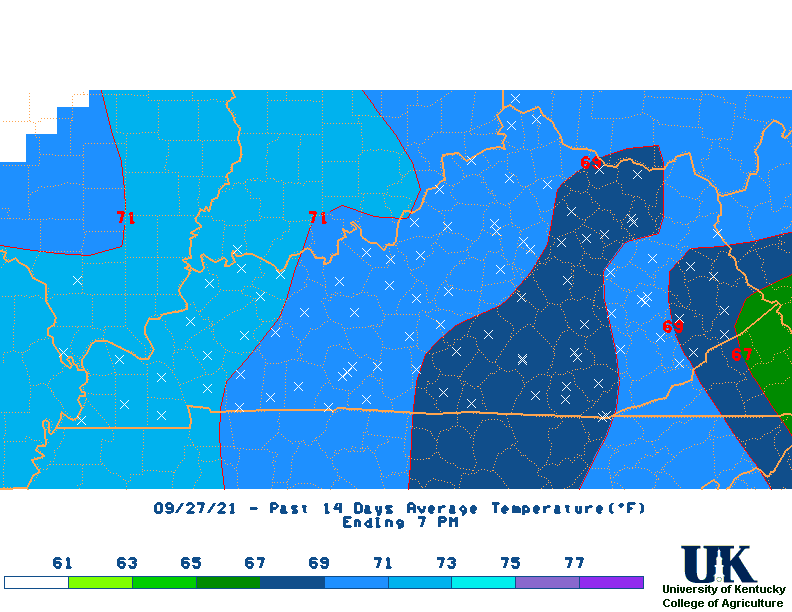
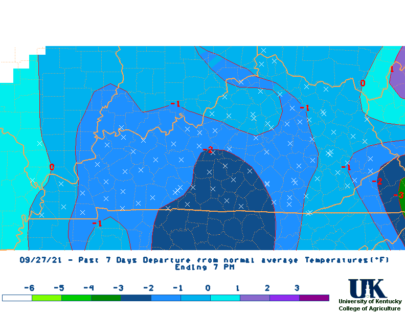
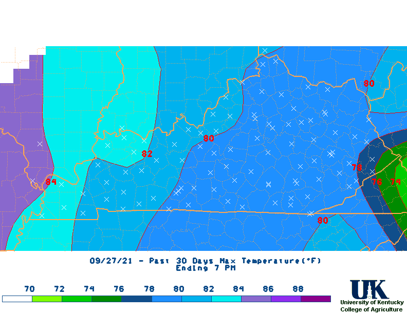
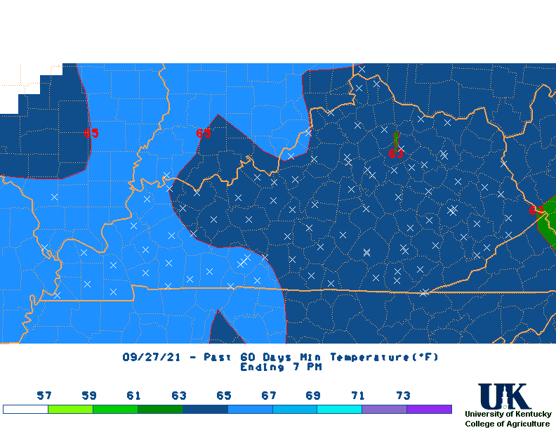
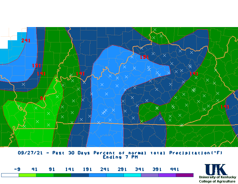 Last 30-day Percent of Normal Map (Updated daily at 10am) |
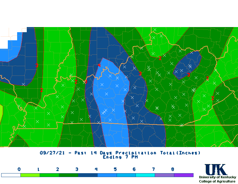
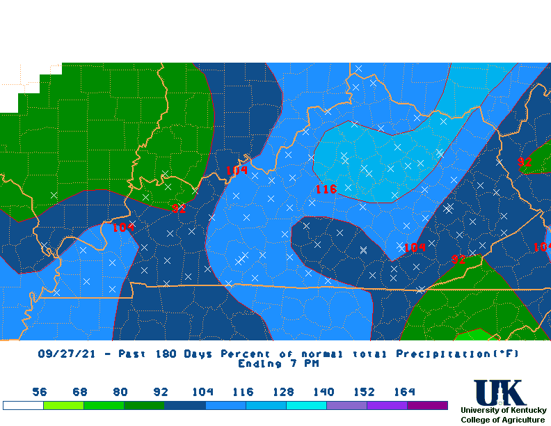
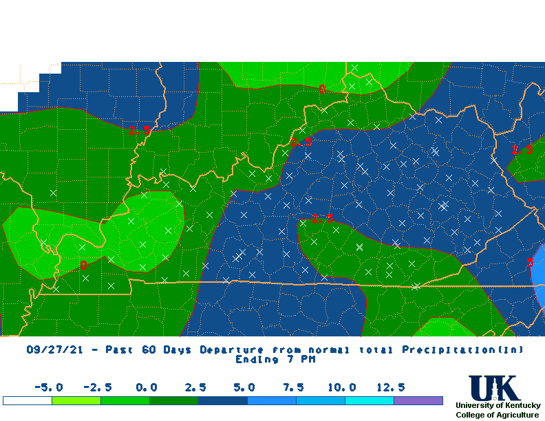
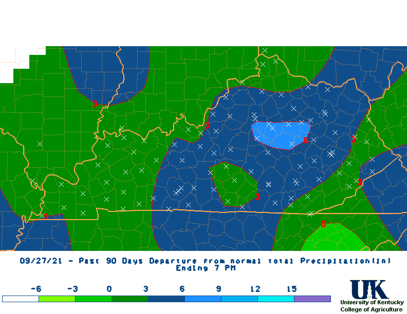
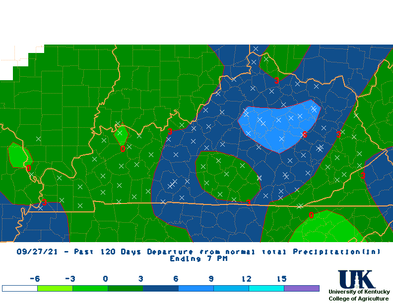
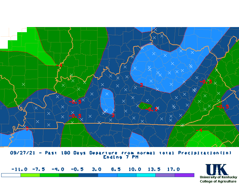
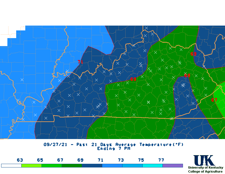
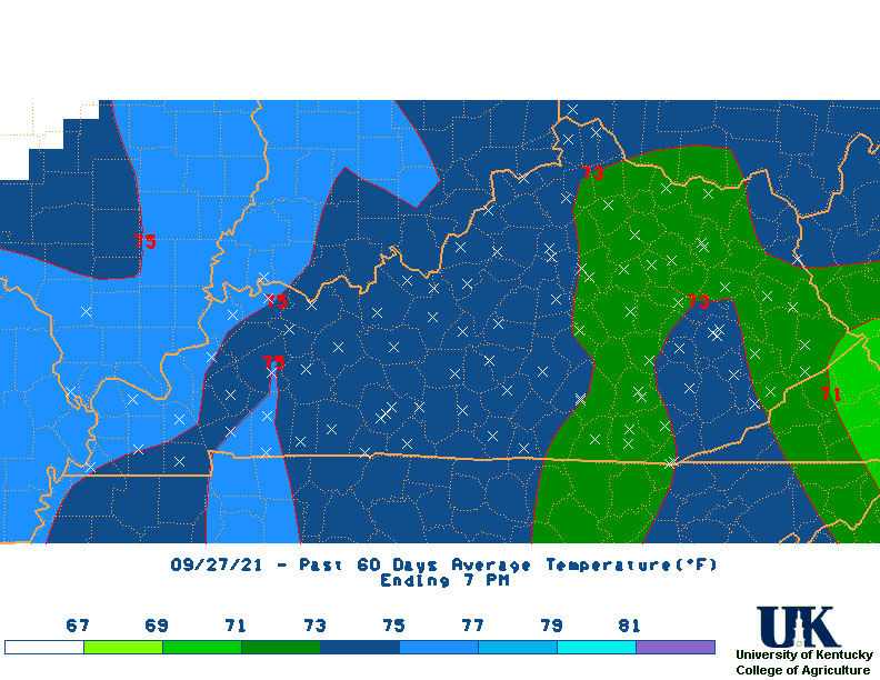
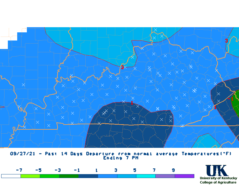
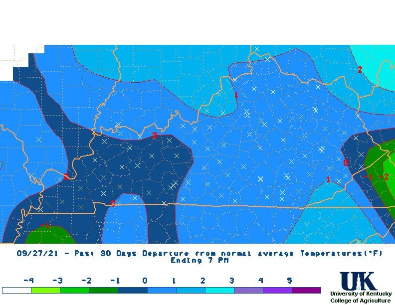
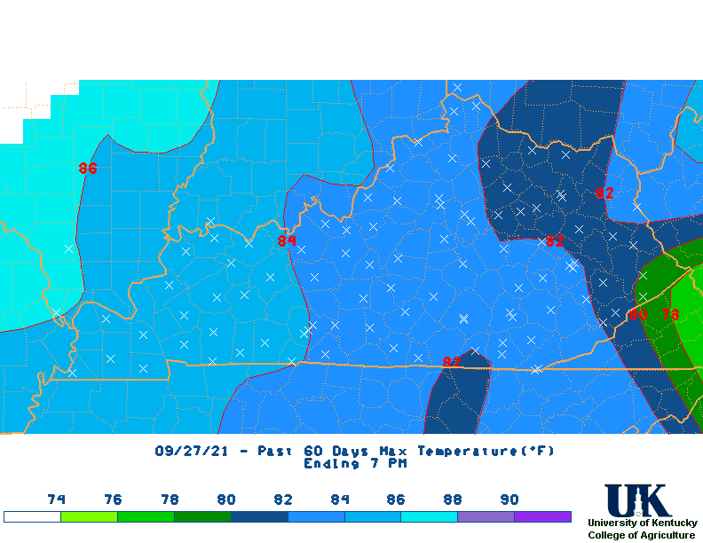
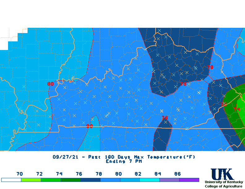
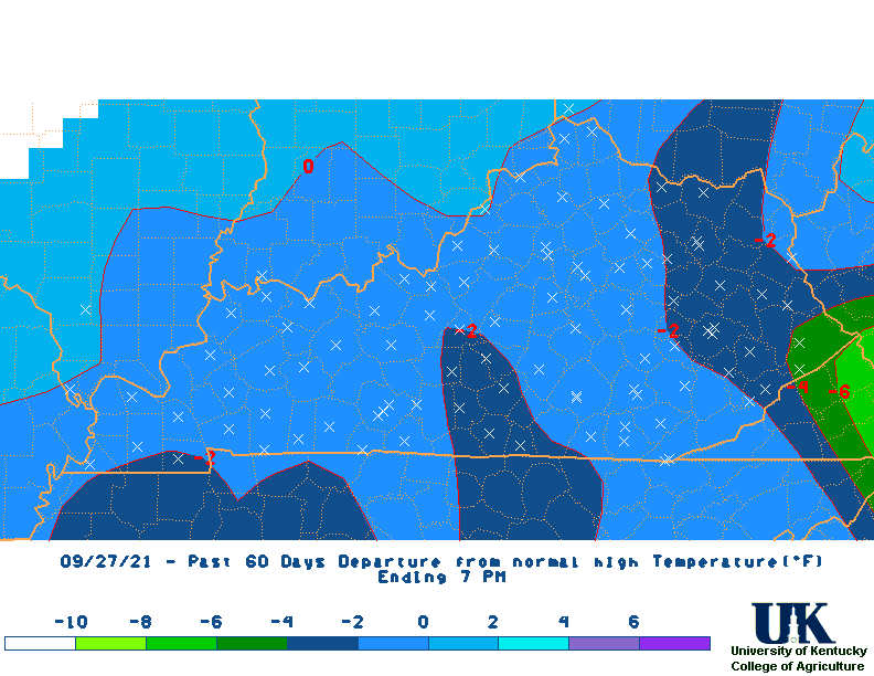
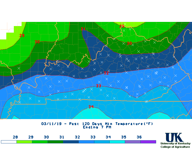
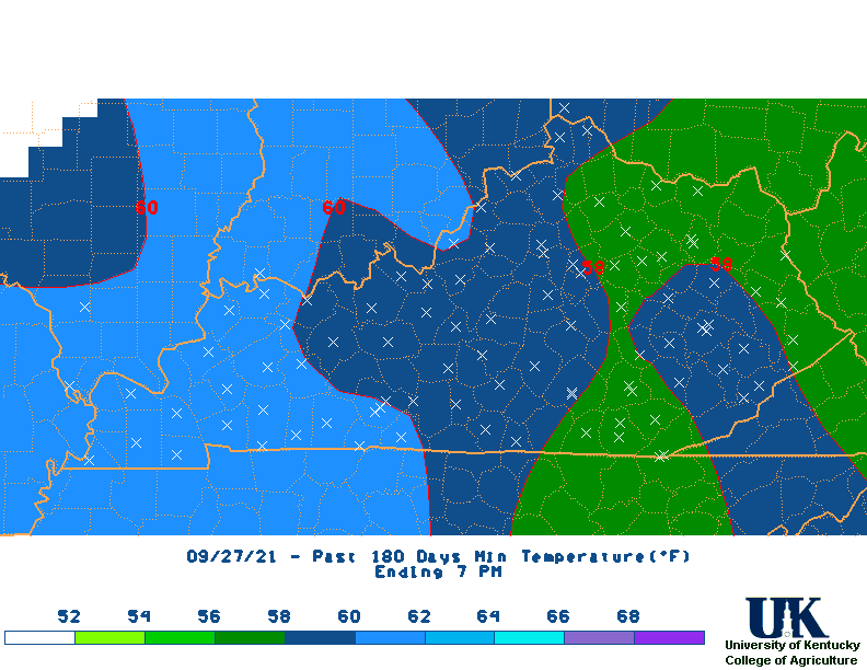
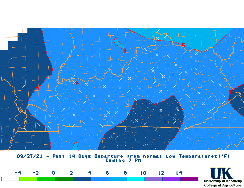
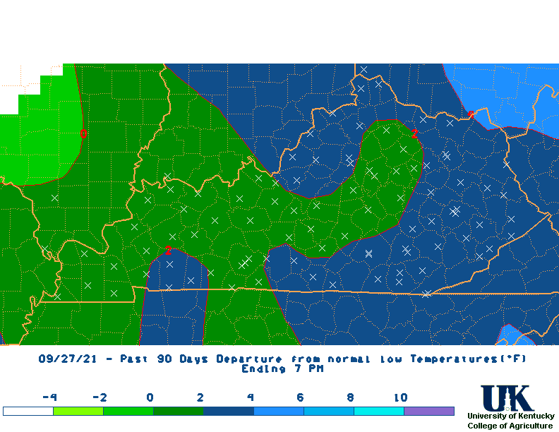
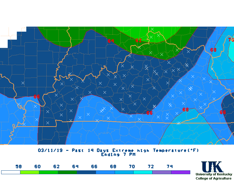
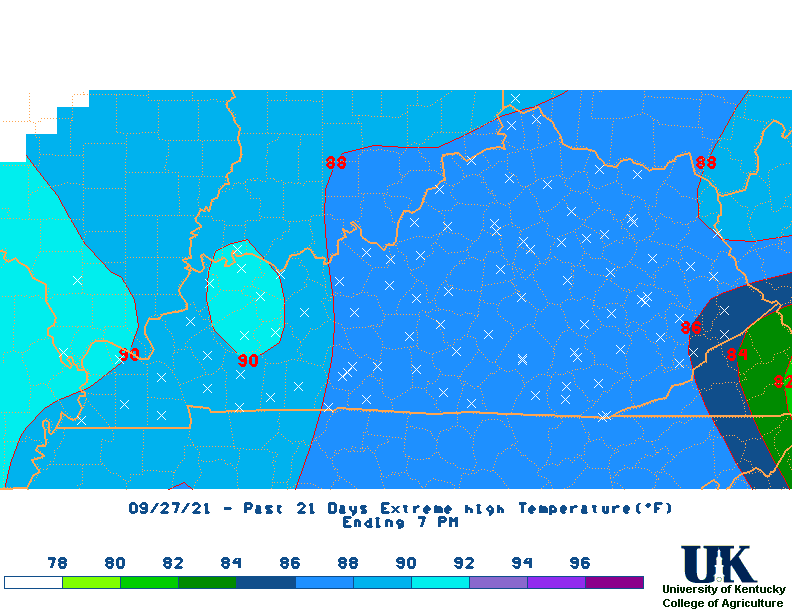
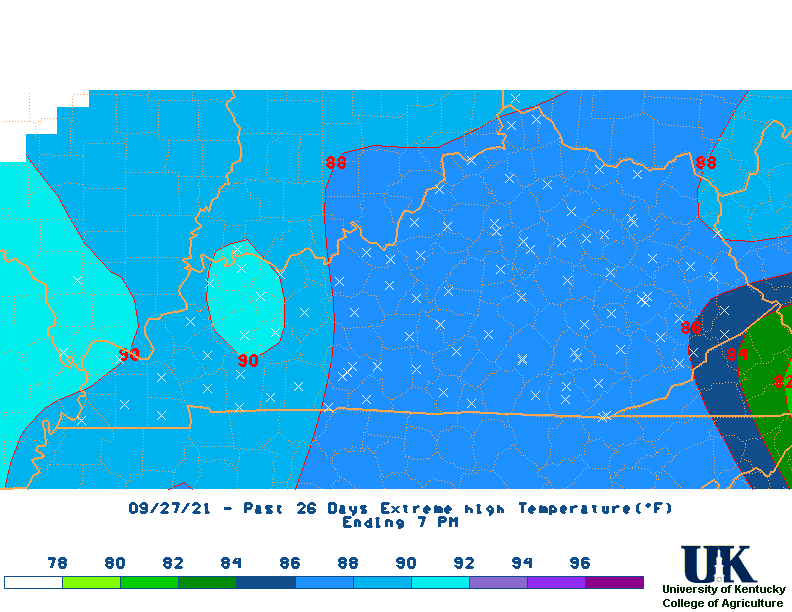
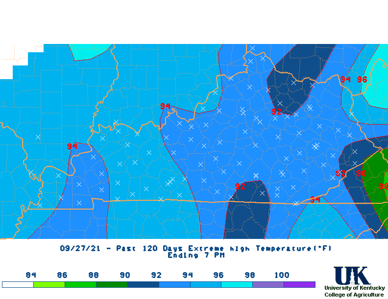
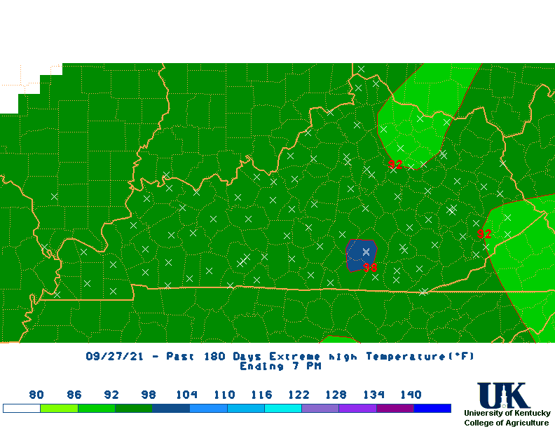
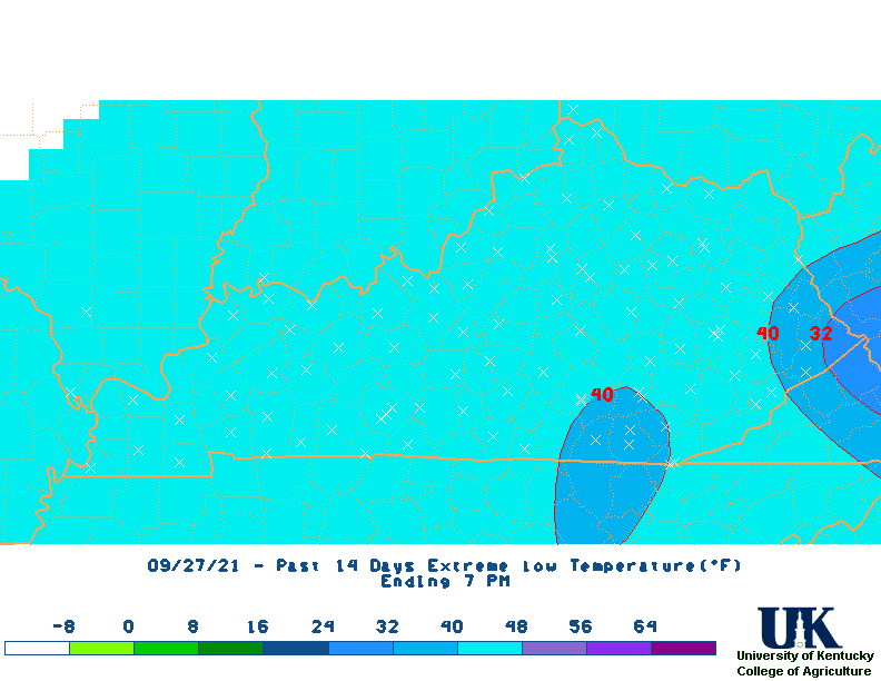
 Last 13 Months Rainfall Departures |
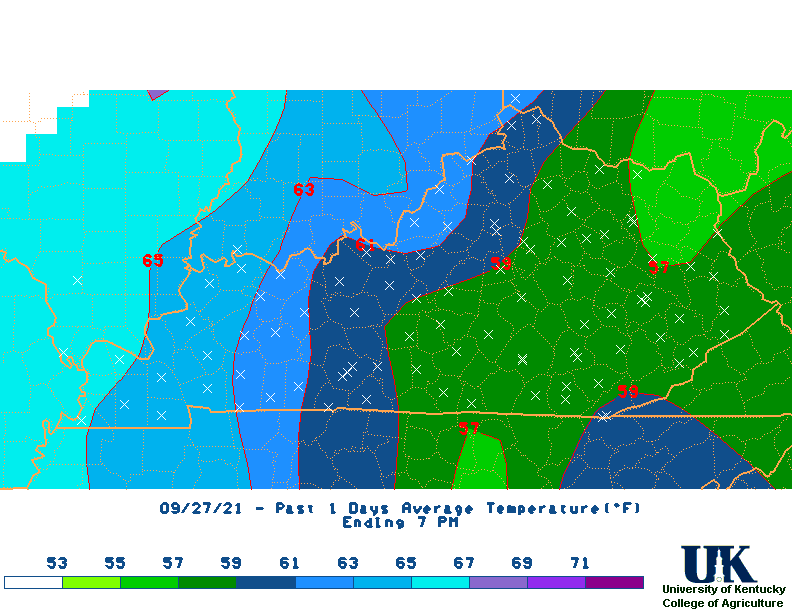
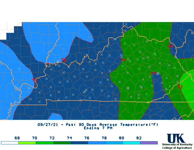
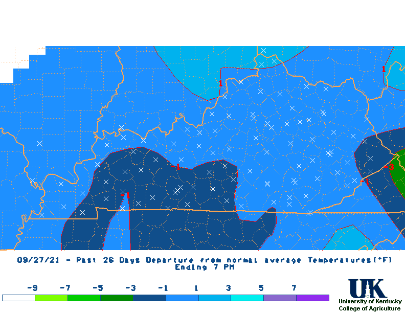
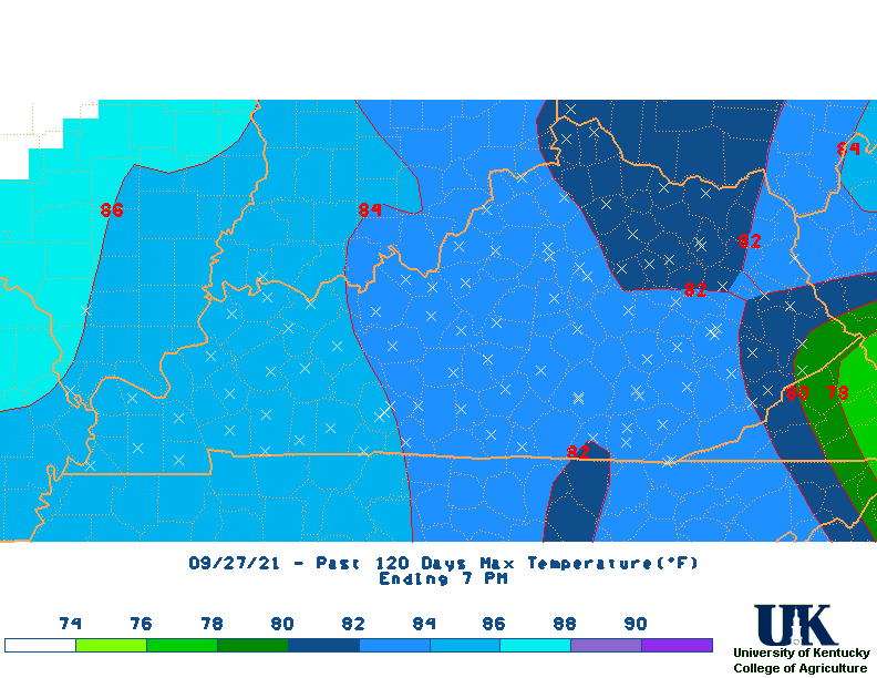
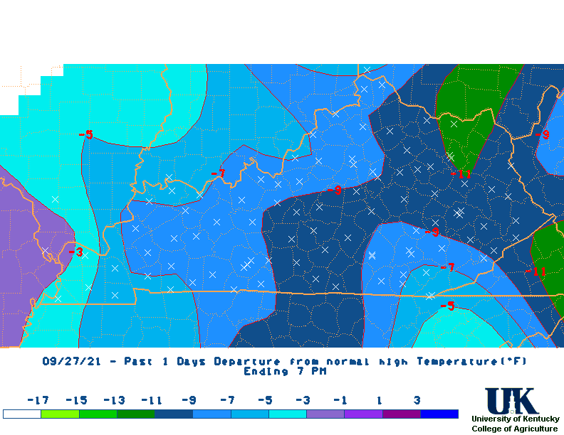
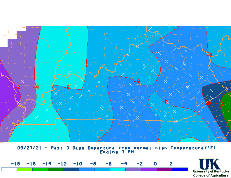
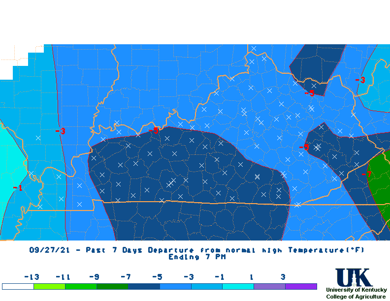
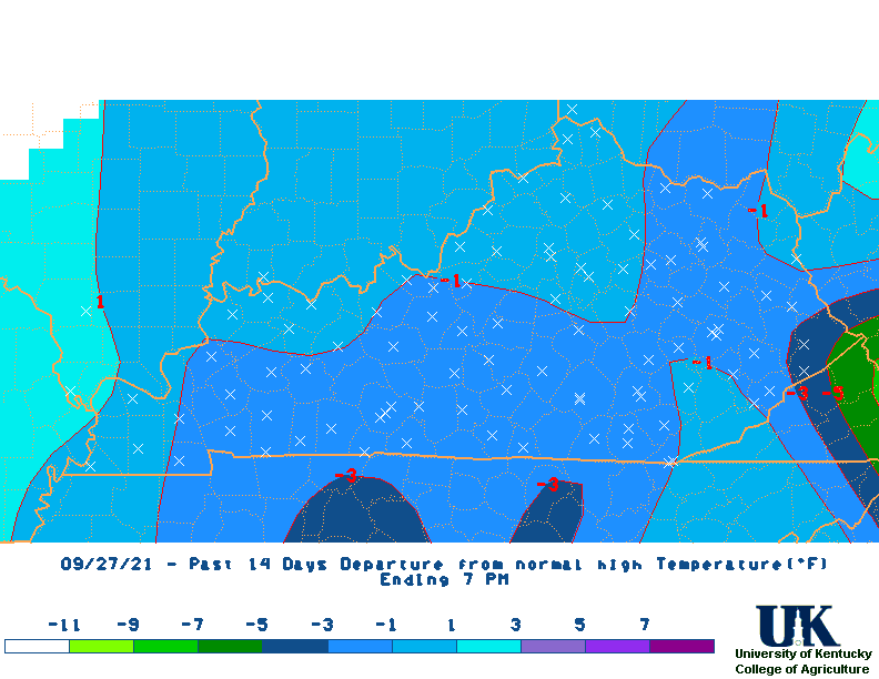
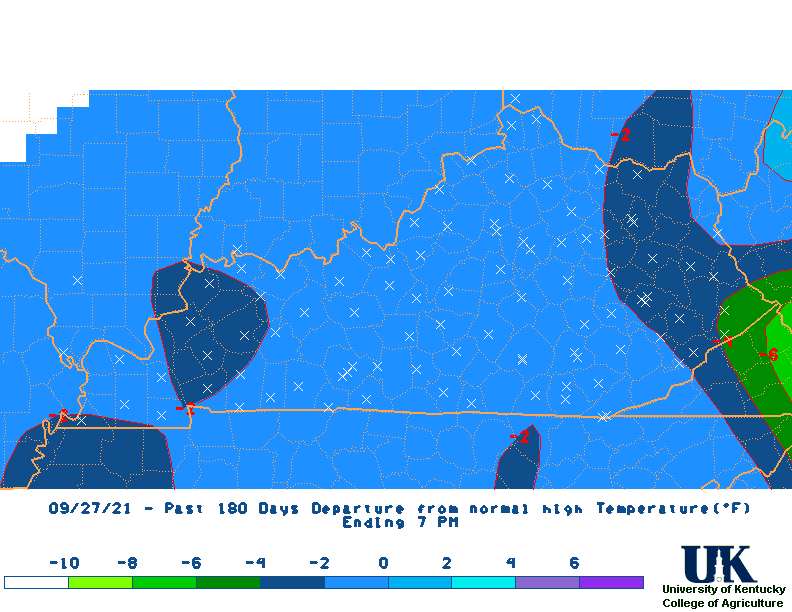
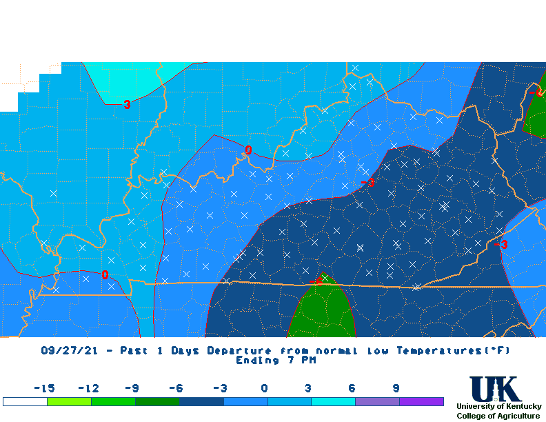
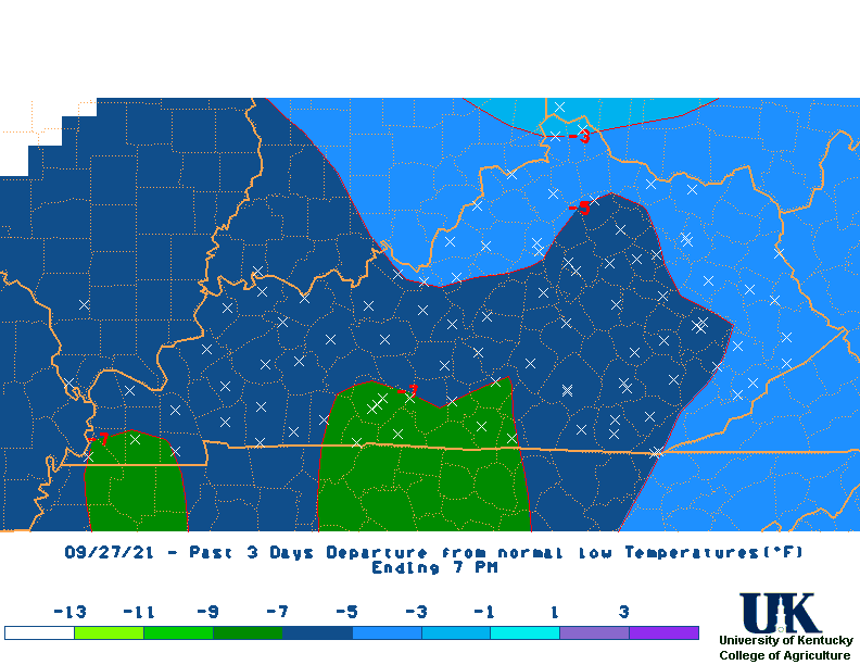
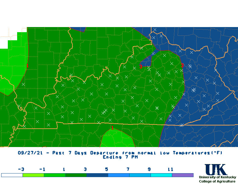
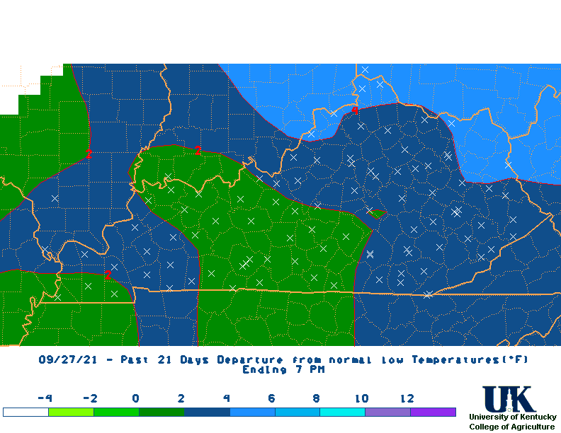
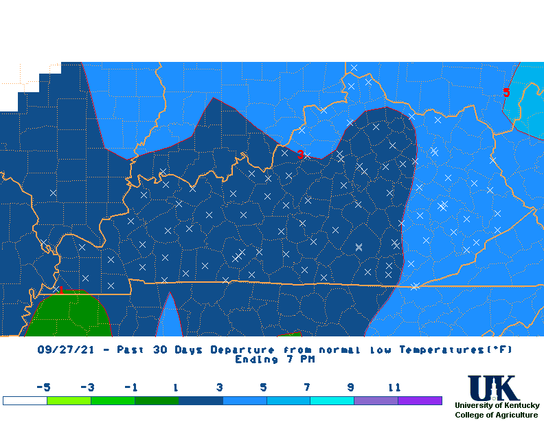
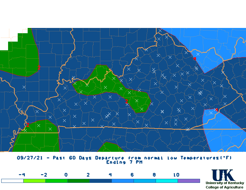
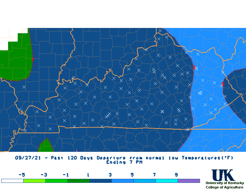
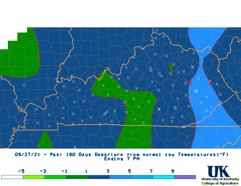
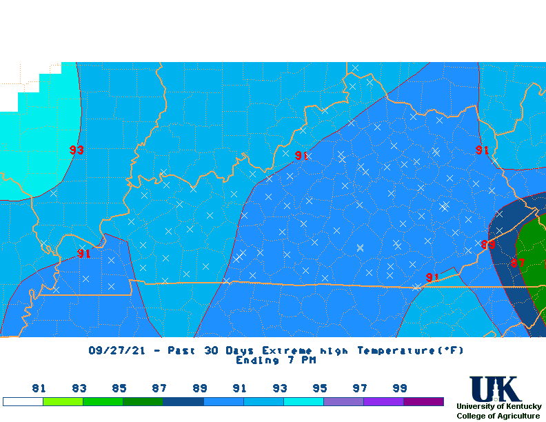
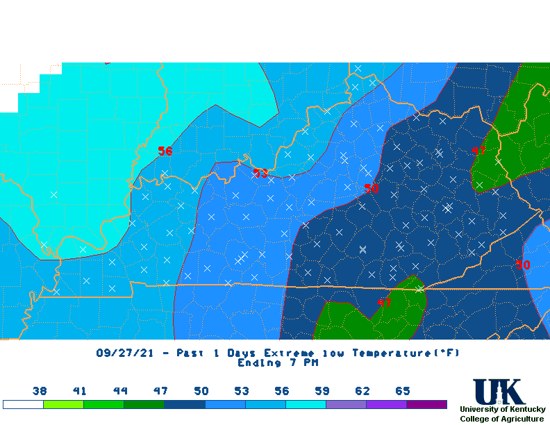
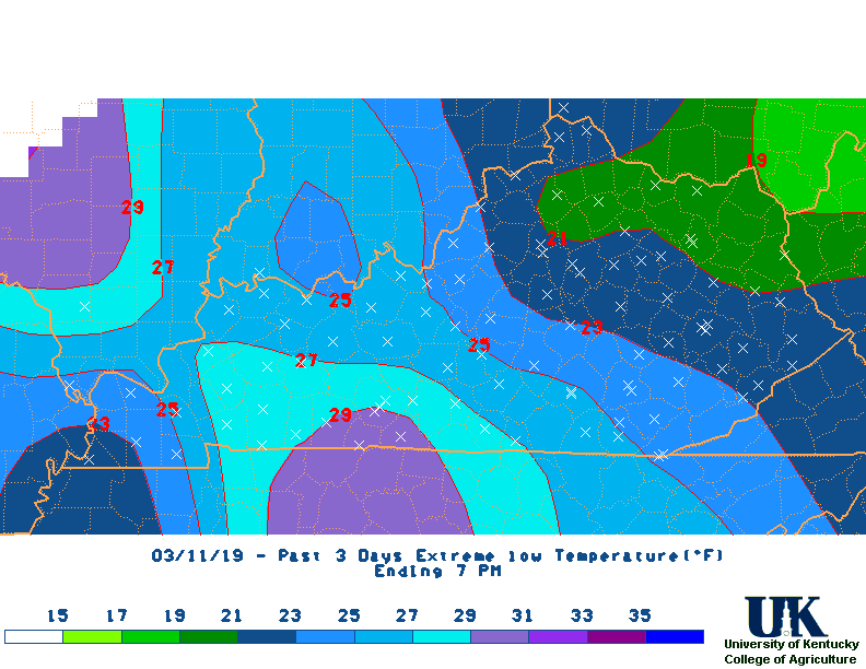
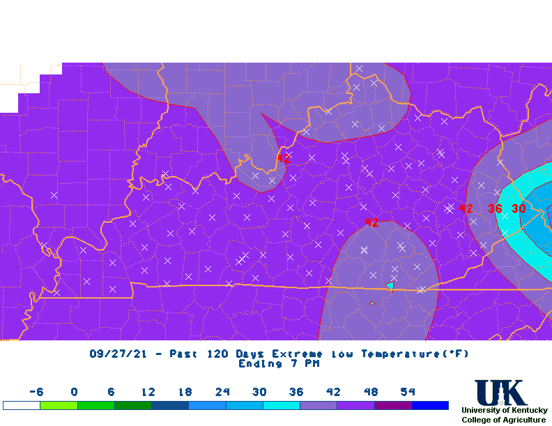
 Last 13 Months Temp. Departures |
![]() UK:
Drought Pictures (2012)
UK:
Drought Pictures (2012)
![]() US Drought Monitor:
Drought Severity Classification
US Drought Monitor:
Drought Severity Classification
![]() University of Kentucky:
Grain Crops Update
University of Kentucky:
Grain Crops Update
![]() MRCC:
Drought Page (includes soil moisture)
MRCC:
Drought Page (includes soil moisture)
![]() CRN:
Soil Temperatures and soil moisture
CRN:
Soil Temperatures and soil moisture
![]() Click here to ask Weather-related questions about Drought
Click here to ask Weather-related questions about Drought
![]() Kentucky Climate Update
Kentucky Climate Update
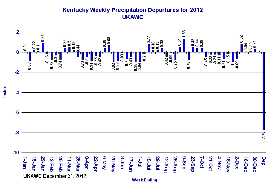
![]() Kentucky Statewide Rainfall (Normal & Departures)
Kentucky Statewide Rainfall (Normal & Departures)
![]() (NEW!):
Midwest Climate Watch (MCC)
(NEW!):
Midwest Climate Watch (MCC)
![]() (NEW!): The Climate Prediction Center has developed a new web site for
'Everything' about Soil Moisture for the U.S.
[More...].
(NEW!): The Climate Prediction Center has developed a new web site for
'Everything' about Soil Moisture for the U.S.
[More...].
![]() Soil Moisture Maps from the Midwest Regional Climate Center here.
Soil Moisture Maps from the Midwest Regional Climate Center here.
![]() Kentucky Division of Water
Kentucky Division of Water
![]() Kentucky Drought Mitigation and Response Plan
Kentucky Drought Mitigation and Response Plan
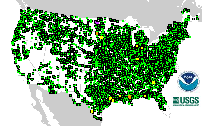
![]() USGS:
WaterWatch -- Current water resources conditions ,
Current Kentucky Streamflows
USGS:
WaterWatch -- Current water resources conditions ,
Current Kentucky Streamflows
![]() CPC:
Rainfall Needed To Return to Normal(
CPC:
Rainfall Needed To Return to Normal(
![]() About the Palmer Drought Severity and Crop Moisture Indices
About the Palmer Drought Severity and Crop Moisture Indices
![]() All States Moisture Status (CPC)- EXCELLENT!
All States Moisture Status (CPC)- EXCELLENT!
USGS & NWS Water/Precip:
CPC Calc. Soil Moisture:

NWS Drought Outlook:

NWS Precip ForecastTotals:

NWS Hazards:

Weather Channel Soil Moisture:

USGS River Obs & River Forecasts:


