


|
|
|
|
 |
 |
 |
 |
 |
 |
 |
 |
Temperatures:
|
Precip: Since Midnight:
|
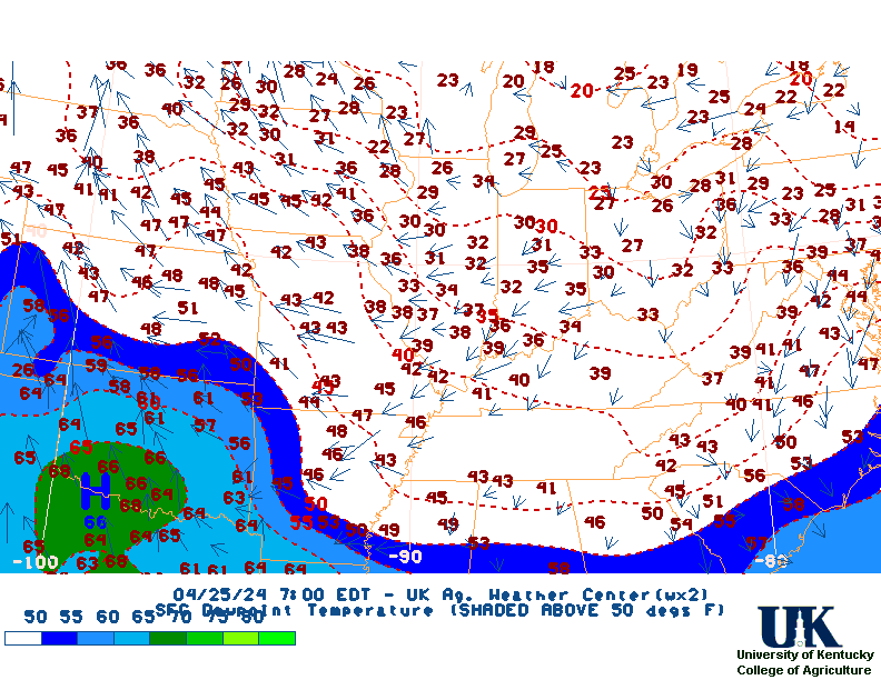
Dewpoint:
|
Min temp:
|
Max temp:
|
Solar Radiation:
|
Home| Current Conditions| Forecasts| Satellite| Radar| Media| Outlooks| Drought| Severe| Tropical Wx| Winter Wx| Climatology| Calc| Fire| NWS| Historical| About Us| Spring Ag-Update| Glance| LexCam | All Ag| All AgObs| Print_scrolling2| 5| 6| 7| GlanceClim|
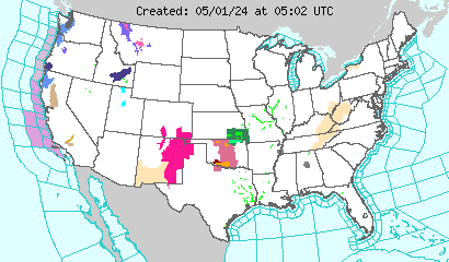
![]()
|
|
Home| Current Conditions| Forecasts| Satellite| Radar| Media| Outlooks| Drought| Severe| Tropical Wx| Winter Wx| Climatology| Calc| Fire| NWS| Historical| About Us| Spring Ag-Update Glance| GlanceClim
![]()
The United States Department of Agriculture
(USDA) divides the United States into 10 climate zones that vary at
10 degree farenheit increments based on average miniumum temperature.
Place Mouse Over Text to Pause....
Click here to view all scrolling forecast
NWS Weather Story
NWS West:

NWS Central:

NWS East:

Temperature
Next 12 Hrs

Next 24 Hrs

Next 36 Hrs

Next 48 Hrs

Probability of Precipitation
Next 12 Hrs

Next 24 Hrs

Next 36 Hrs

Next 48 Hrs

Weather Conditions
Next 12 Hrs

Next 24 Hrs

Next 36 Hrs

Next 48 Hrs

Convective Outlook
Next 12 Hrs

Next 24 Hrs

Next 36 Hrs

Next 48 Hrs


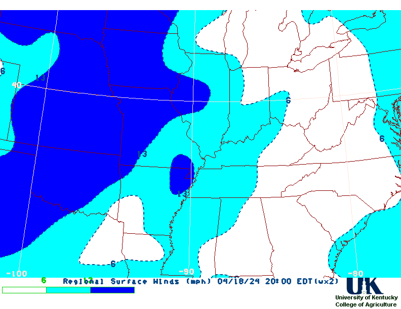
Winds
Next 12 Hrs

Next 24 Hrs

Next 36 Hrs

Next 48 Hrs

SPECIAL WEATHER STATEMENTS FOR KENTUCKY
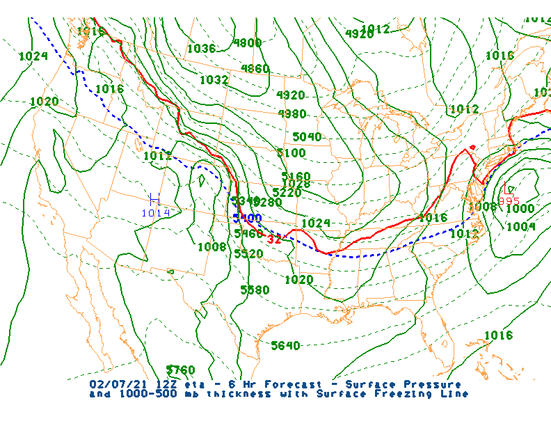
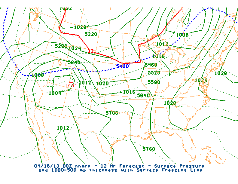
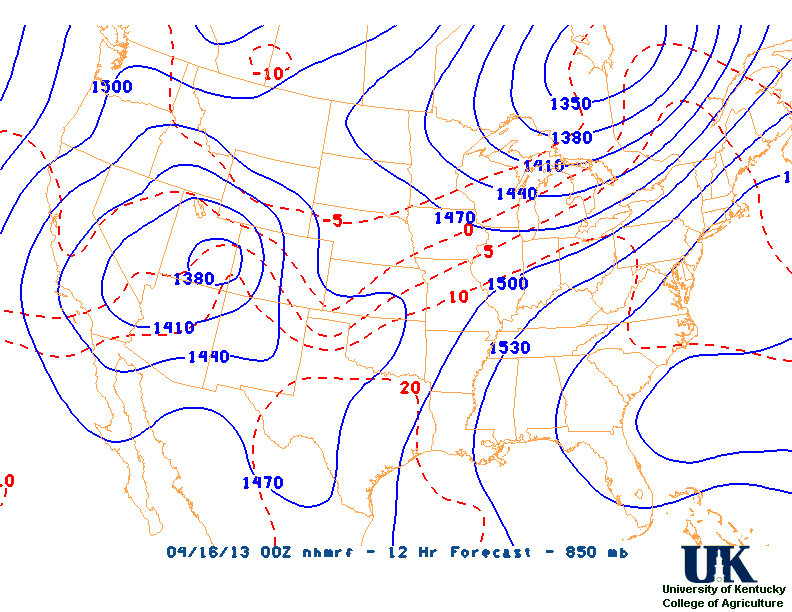
Click here for more ndfd maps.
Kentucky Short-Term Summary
Click here for test summaries.
Click here for the PAH,LEX & JKL point ag cast.
Text page
============================================================================


