Weather and Climate Synopsis
|
|
McHenry County, Illinois Weather and Climate Synopsis |

[National] [International] [Learning] [EWOCK] [Reg Clim Ctrs] |
(Click image to zoom) or
Click Here
Satellite images from NOAA
Also see NWS Watch/Warning Maps |
A joint service of the UK Ag Weather Center and the National Weather Service.
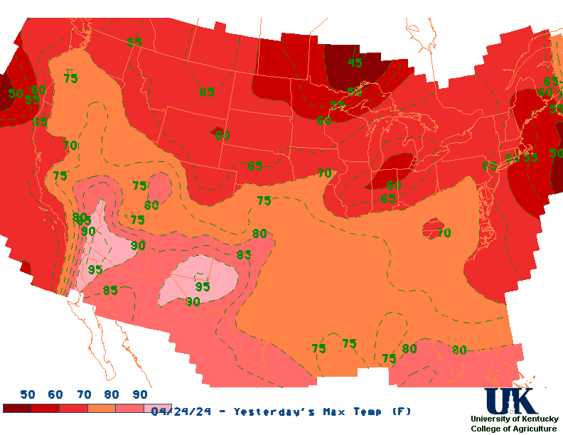
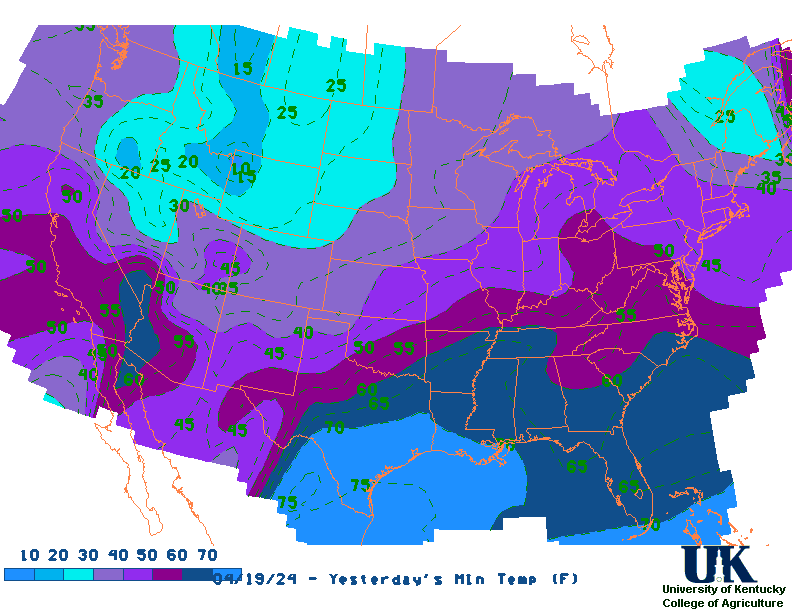
![]() Current Surface Map, [TWC], Yesterday's Highs , Lows
Current Surface Map, [TWC], Yesterday's Highs , Lows ![]() Map of 24 Hr Rainfall (7AM - 7AM EST), 7 Day Rainfall Animation
Map of 24 Hr Rainfall (7AM - 7AM EST), 7 Day Rainfall Animation
NORTHEAST ILLINOIS

CITY           SKY/WX    TMP DP  RH WIND       PRES   REMARKS
CHICAGO-OHARE  MOCLDY    54  47  77 N9        29.96S TC  12
CHICAGO-MIDWAY MOCLDY    58  47  66 N9        29.97R TC  14
AURORA         CLEAR     50  46  86 N8        29.98S TC  10
JOLIET*        CLOUDY    57  50  78 N7        29.98S TC  14
WAUKEGAN       PTCLDY    52  46  80 NW6       29.97R TC  11
DUPAGE AIRPORT MOCLDY    53  47  79 N10       29.98R TC  12
KANKAKEE*      CLOUDY    57  50  77 N12       29.98R TC  14
WHEELING       MOCLDY    54  48  80 N9        29.99R TC  12
MORRIS*        CLOUDY    53  50  90 N5        29.98S TC  12
ROMEOVILLE*    CLOUDY    55  52  88 N12G18    29.99S TC  13
LANSING*       CLOUDY    56  50  79 N12G18    29.97R TC  14
NORTHERLY ISL*   N/A     56  47  71 NW9         N/A  TC  13
![]() Current Temperatures, Dewpoint Map, RH, Wind, Regional Obs, Surface 4-Panel
Current Temperatures, Dewpoint Map, RH, Wind, Regional Obs, Surface 4-Panel
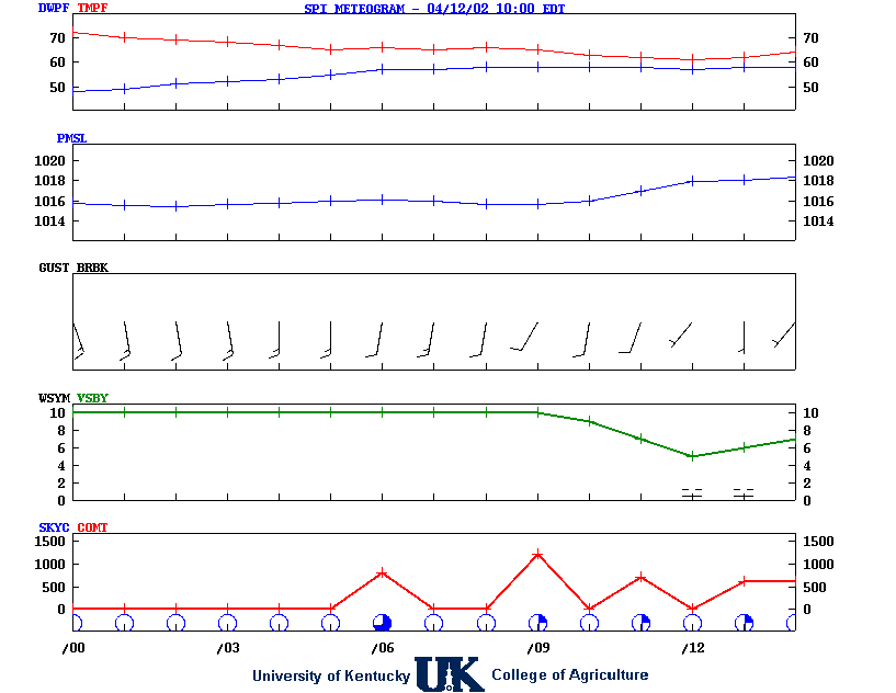
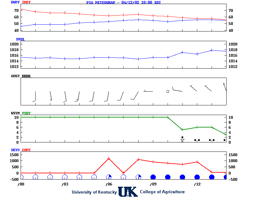
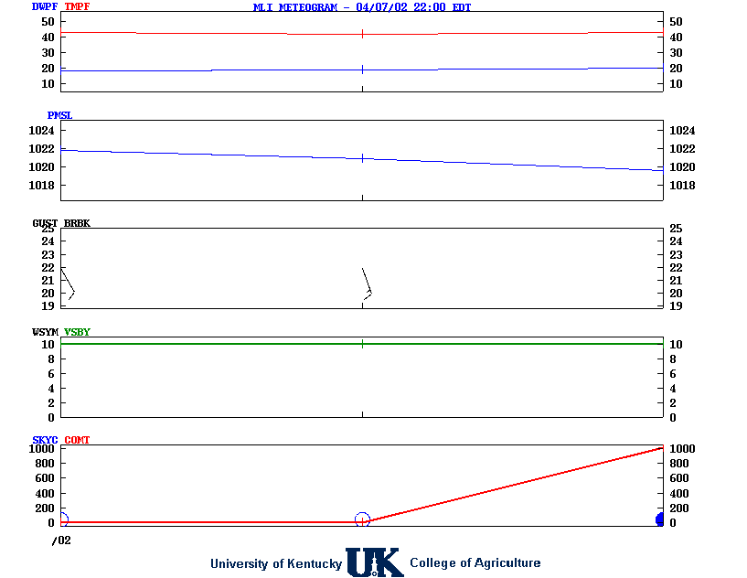
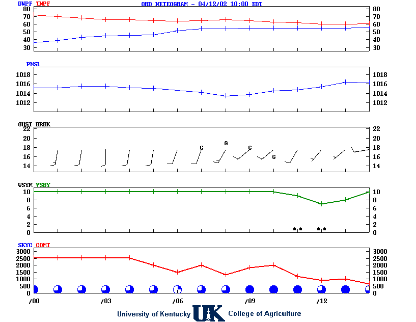
![]() Meteograms : Springfield , Peoria , Quad City , Chicago (O'Hare) , Rockford
Meteograms : Springfield , Peoria , Quad City , Chicago (O'Hare) , Rockford
.TODAY...Mostly sunny. Highs in the mid 60s. Northeast winds 5 to
10 mph.
.TONIGHT...Mostly clear. Lows in the lower 40s. East winds around
5 mph.
.MONDAY...Mostly sunny. Highs around 70. East winds 10 to 15 mph.
.MONDAY NIGHT...Mostly clear in the evening, then mostly cloudy
with a chance of showers with a slight chance of thunderstorms
after midnight. Lows in the mid 50s. Southeast winds 10 to
15 mph. Chance of precipitation 50 percent.
.TUESDAY...Showers with a chance of thunderstorms in the morning,
then showers likely with a chance of thunderstorms in the
afternoon. Highs in the lower 70s. Southeast winds 10 to 15 mph
in the morning, becoming southwest in the afternoon. Gusts up to
25 mph. Chance of precipitation 90 percent.
.TUESDAY NIGHT...Partly cloudy with a slight chance of
thunderstorms in the evening, then mostly clear after midnight.
Lows in the lower 50s. Chance of precipitation 20 percent.
.WEDNESDAY...Partly cloudy in the morning, then mostly cloudy
with a chance of showers with a slight chance of thunderstorms in
the afternoon. Highs in the mid 70s. Chance of precipitation
50 percent.
.WEDNESDAY NIGHT...Mostly cloudy. Showers likely with a chance of
thunderstorms in the evening, then a chance of thunderstorms
after midnight. Lows in the lower 50s. Chance of precipitation
60 percent.
.THURSDAY...Mostly cloudy. A chance of showers. Highs around 60.
Chance of precipitation 50 percent.
.THURSDAY NIGHT...Mostly cloudy with a chance of showers in the
evening, then partly cloudy after midnight. Lows in the mid 40s.
Chance of precipitation 30 percent.
.FRIDAY...Mostly cloudy with a chance of showers in the morning,
then partly cloudy with a chance of showers in the afternoon.
Highs in the lower 60s. Chance of precipitation 40 percent.
.FRIDAY NIGHT...Partly cloudy. Lows in the lower 40s.
.SATURDAY...Partly cloudy. Highs in the mid 60s.
![]() 12-48 Hr Surface, 12-48 Hr ETA 500mb/Sfc, TWC Forecast, Fire Danger, Day 1 Precip, Day 2
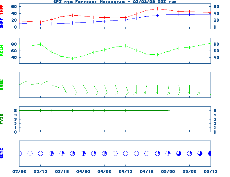
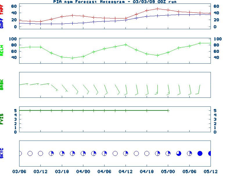
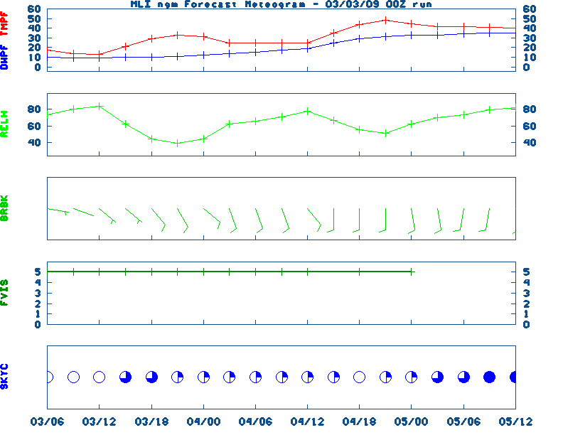
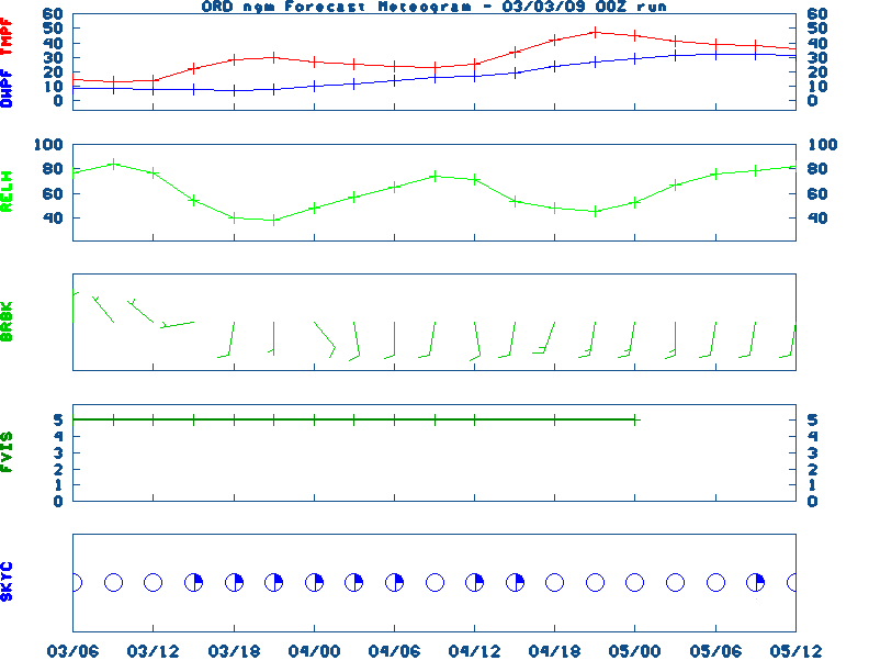
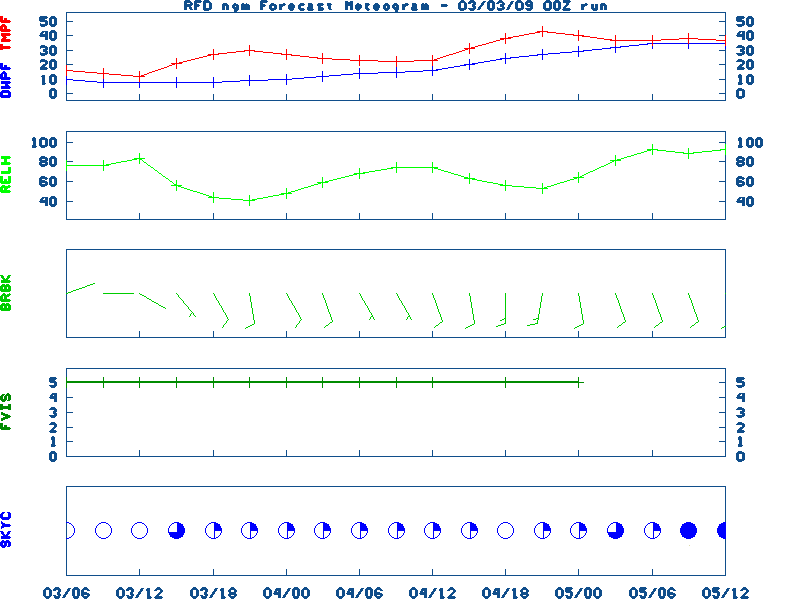
12-48 Hr Surface, 12-48 Hr ETA 500mb/Sfc, TWC Forecast, Fire Danger, Day 1 Precip, Day 2![]() NGM 60 Hr Forecast Meteograms : Springfield , Peoria , Quad City , Chicago (O'Hare) , Rockford ,
NGM 60 Hr Forecast Meteograms : Springfield , Peoria , Quad City , Chicago (O'Hare) , Rockford ,
                 6 TO 10 DAY  8 TO 14 DAY   30 DAY    90 DAY     120 DAY    180 DAY
                                           NOV05   NOV05-JAN06 DEC05-FEB06 FEB06-APR06
                 -----------  -----------  --------  ---------  ---------  ---------
   Temperature:      Below        Below      Above     Normal     Normal     Normal
 Precipitation:      Below        Below     Normal     Normal     Normal     Normal

....  Medium and long range outlooks provided by NCEP/K. Thomas Priddy
Sunday May 05, 2024 the 126th Day of Year

---------------------------------------------------
SUN
Declination 16.690000
Distance 0.999718 AU
Rise 06:53 EDT Set 20:59 EDT
Transit Meridian 13:55 EDT
Civil Twilight Begins 06:25 EDT Ends 21:27 EDT

Calculations made for central point in the state.
Time in ET -- and will vary due to location and
elevation -- Priddy
///////////////////////////////
MAY 5TH...HISTORIC WEATHER EVENTS
...1917...
The same storm which a day earlier produced eight inches of snow in the Texas
panhandle, produced a foot of snow at Denver CO, their heaviest snow
of record for the month of May. (David Ludlum)
...1930...
The temperature at College Park VA soared from 43 degrees to 93 degrees to
begin an exceptional heat wave. (Sandra and TI Richard Sanders - 1987)
...1987...
Unseasonably hot weather prevailed in the western U.S. A dozen cities in
California reported record high temperatures for the date. Afternoon highs
of 93 degrees at San Francisco, 98 degrees at San Jose, 100 degrees at
Sacramento, and 101 degrees at Redding, were the warmest of record for so
early in the season. The high of 94 degrees at Medford OR was also the
warmest of record for so early in the season. (The National Weather
Summary)
...1989...
Damage was in the millions as the funnel cut a swath across Cleveland,
Lincoln, and Catawba counties in North Carolina. The F4 tornado killed 4
and injured 52.
...1996...
Flash flooding occurred in Pike and Morgan counties Kentucky. Heavy rain
produced flooding along route 460 near Cottle in Morgan county.
However...the flooding was much worse in northern and eastern sections of
Pike county...where damage was estimated at one million dollars. Up to two
and a half inches of rain fell during a short period of time in Pike
county. Forty to fifty bridges were washed out...numerous roads were
flooded and automobiles were washed down creeks. The Varney elementary
school suffered serious flood damage. (NWS Jackson, KY)
|
|
|
![[TWC]](http://www.weather.com/images/maps/current/curwx_440x275.gif)