

The weather data below is provided by the Kentucky Mesonet at Western Kentucky University and the
National Weather Service. Data is digested into the system each day by taking the 24
hour average weather data from 7 PM to 7 PM. The program should not be used for legal
purposes. Each table, map, and narrative is generated according to each time period
to the right. An example would be if the 7 day climate table was selected, it would
display a table of the average weather conditions
observed across the state over the past week.
| Climate Tables | 1 Day | 3 | 7 | 14 | 21 | M2D | 30 | 60 | 90 | 120 | 180 | 360 |
| Climate Narratives | 1 Day | 3 | 7 | 14 | 21 | M2D | 30 | 60 | 90 | 120 | 180 | 360 |
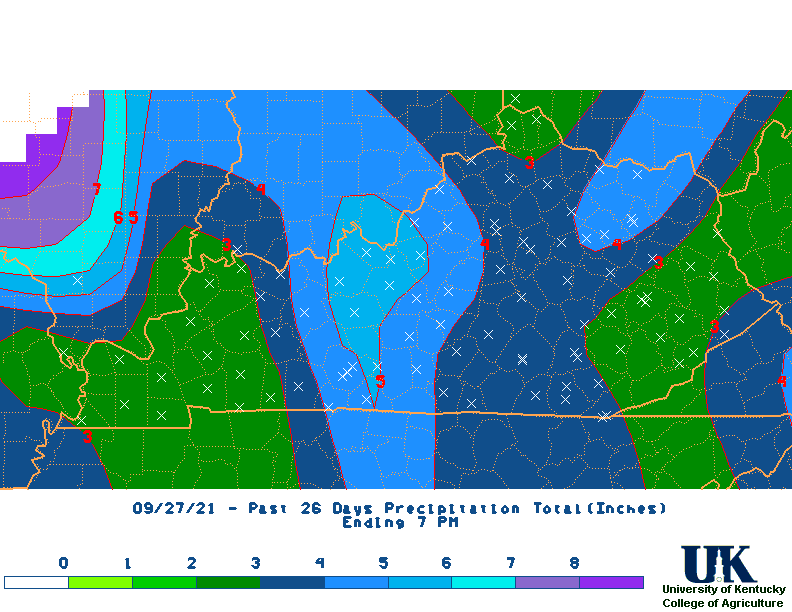
| Rainfall Total Maps |  1 Day |
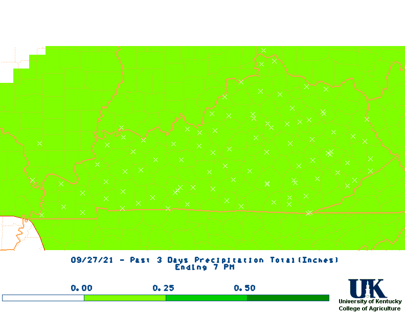 3 |
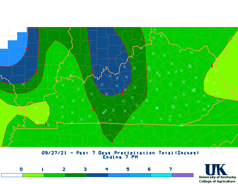 7 |
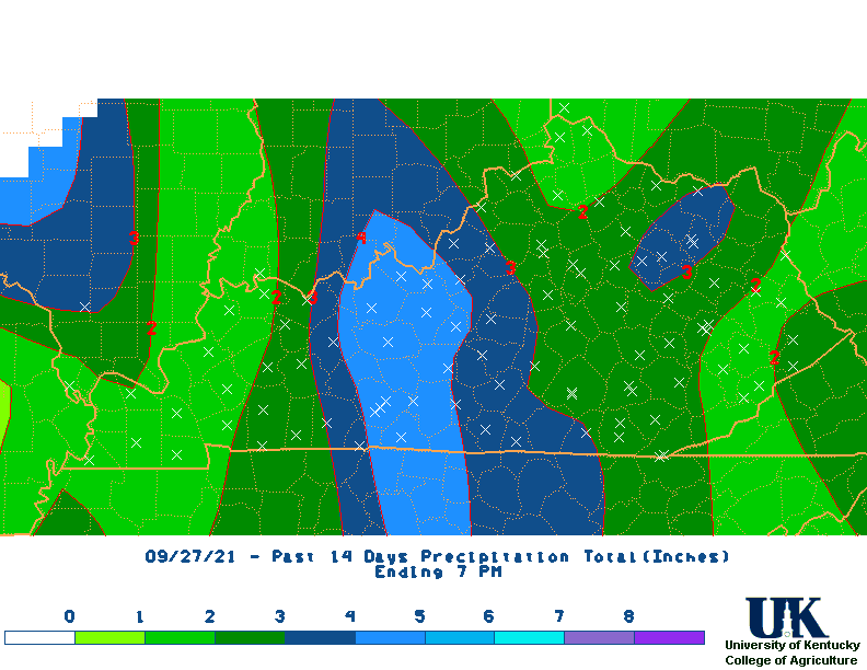 14 |
 21 |
 M2D |
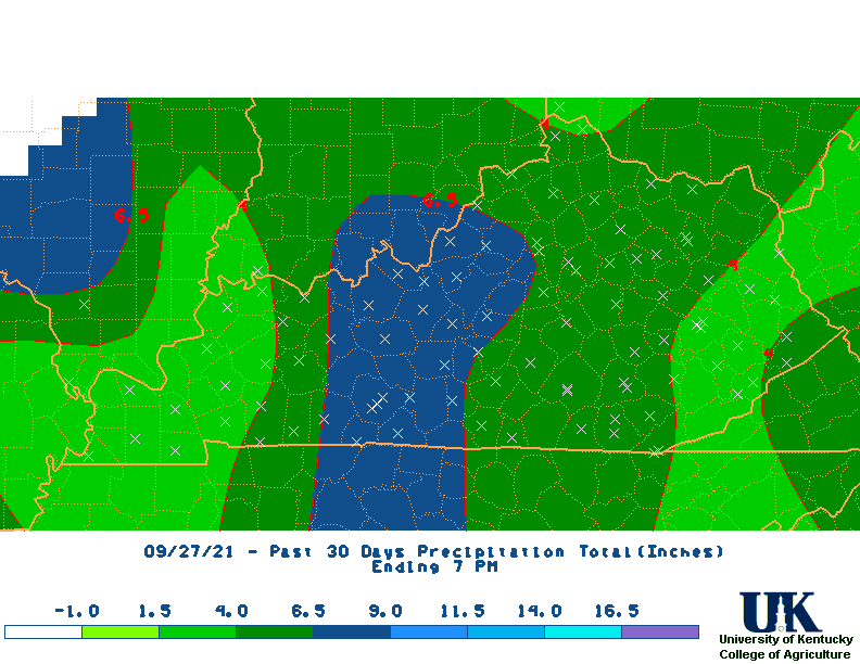 30 |
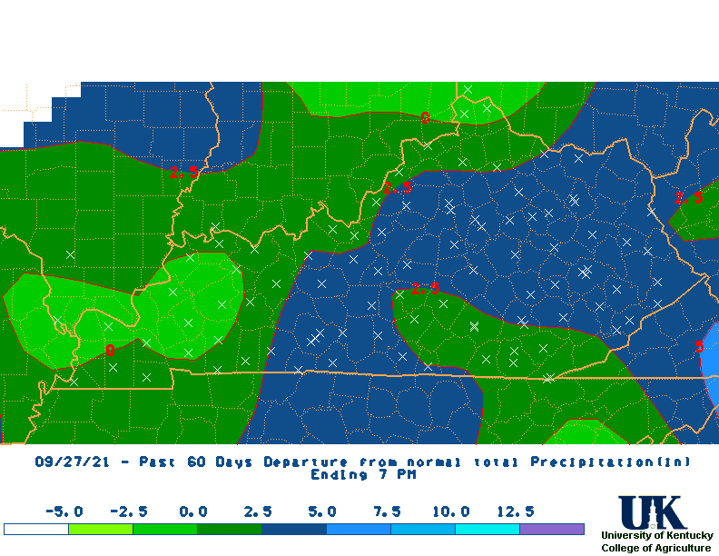
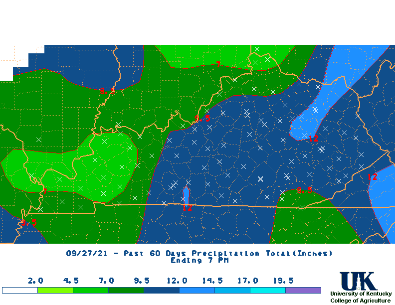 60 |
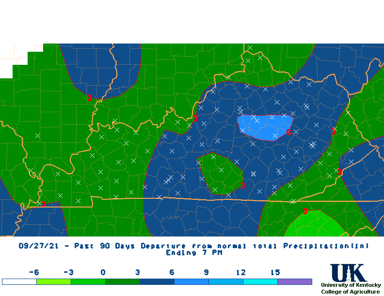
 90 |
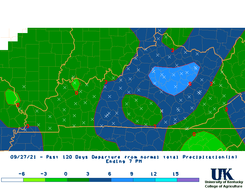
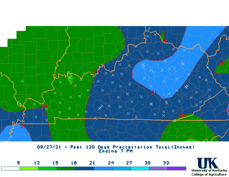 120 |
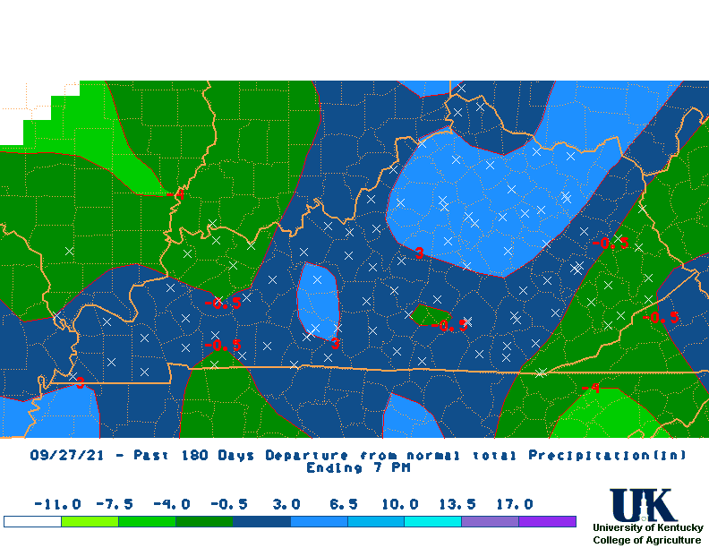
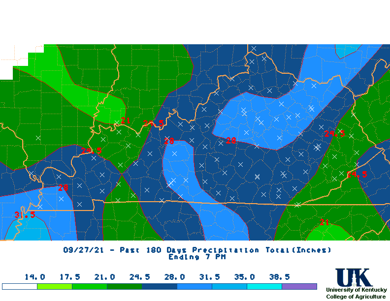 180 |
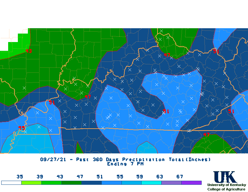 360 |
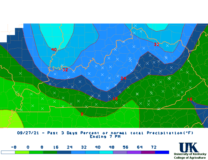
| Percent of Normal Rainfall Maps | 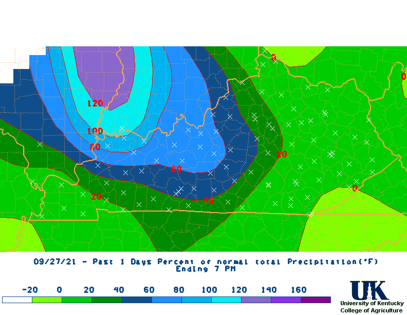 1 Day |
 3 |
 7 |
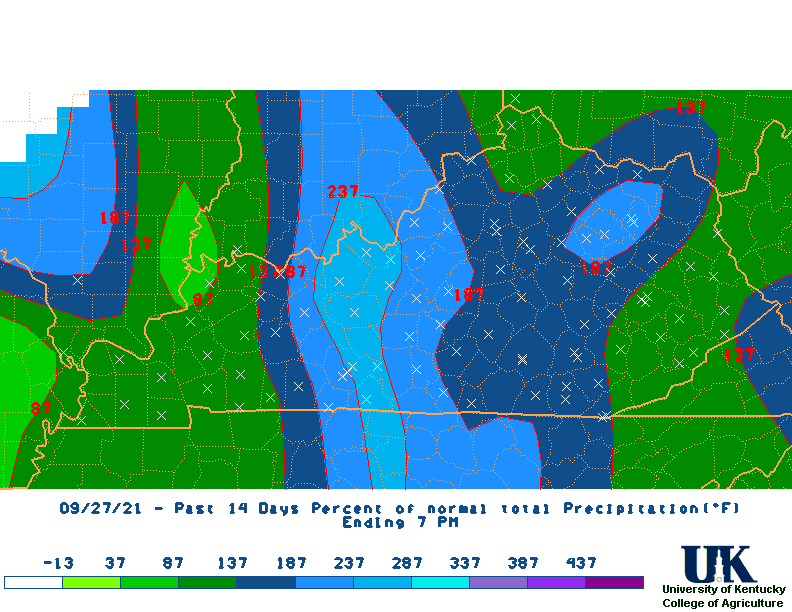 14 |
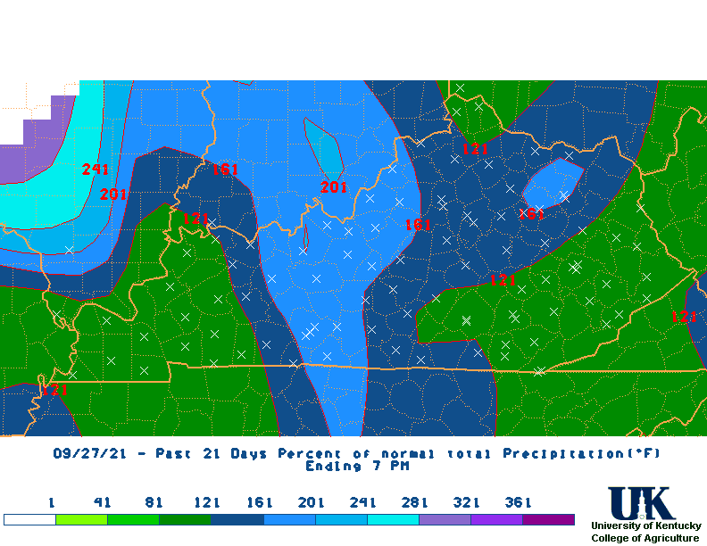 21 |
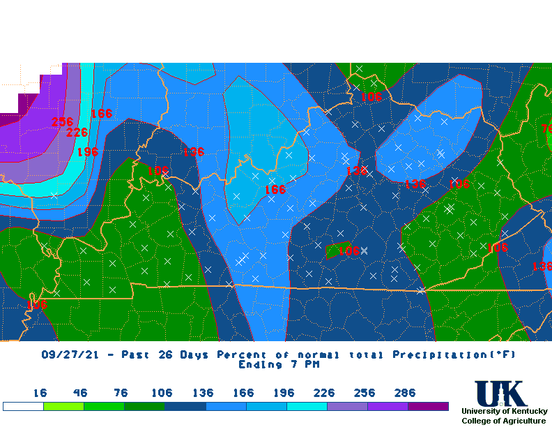 M2D |
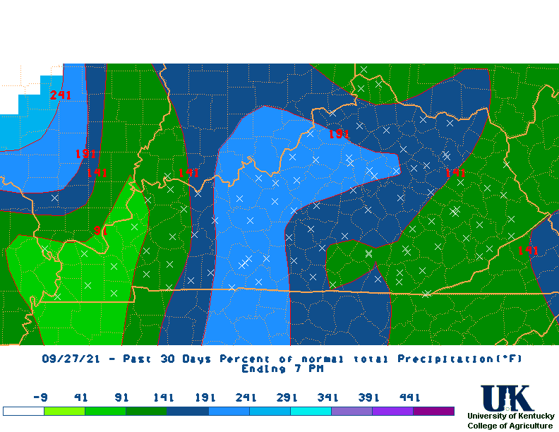 30 |
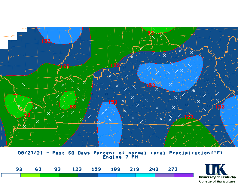 60 |
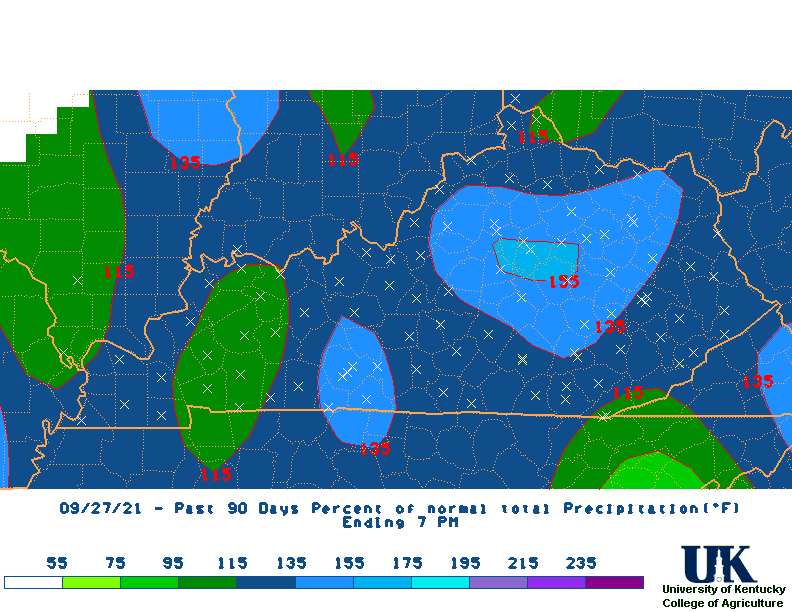 90 |
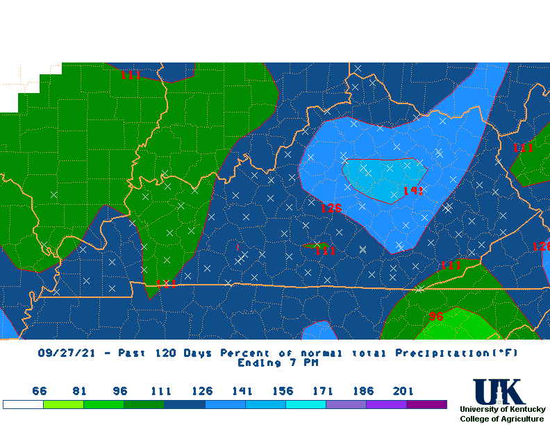 120 |
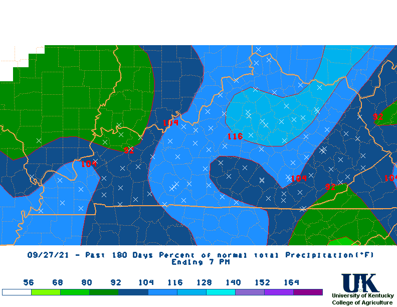 180 |
 360 |
| Rainfall Departure Maps | 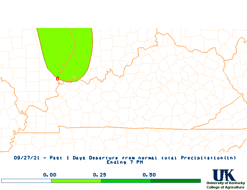 1 Day |
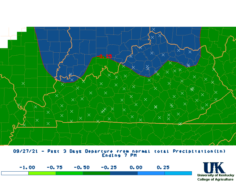 3 |
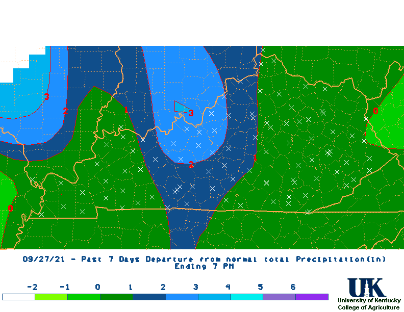 7 |
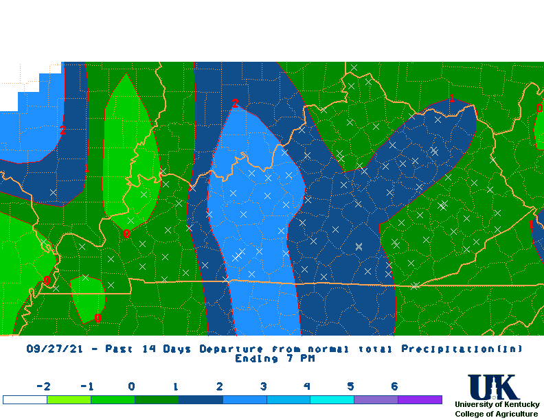 14 |
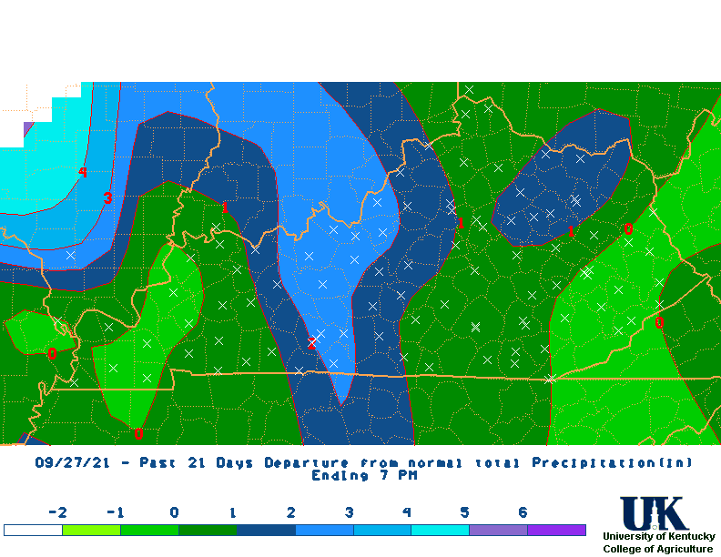 21 |
 M2D |
 30 |
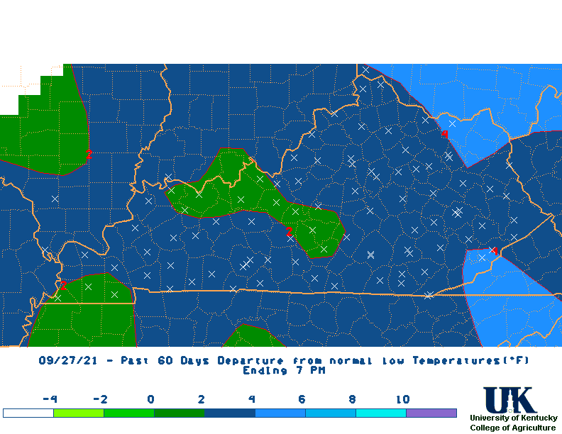
 60 |
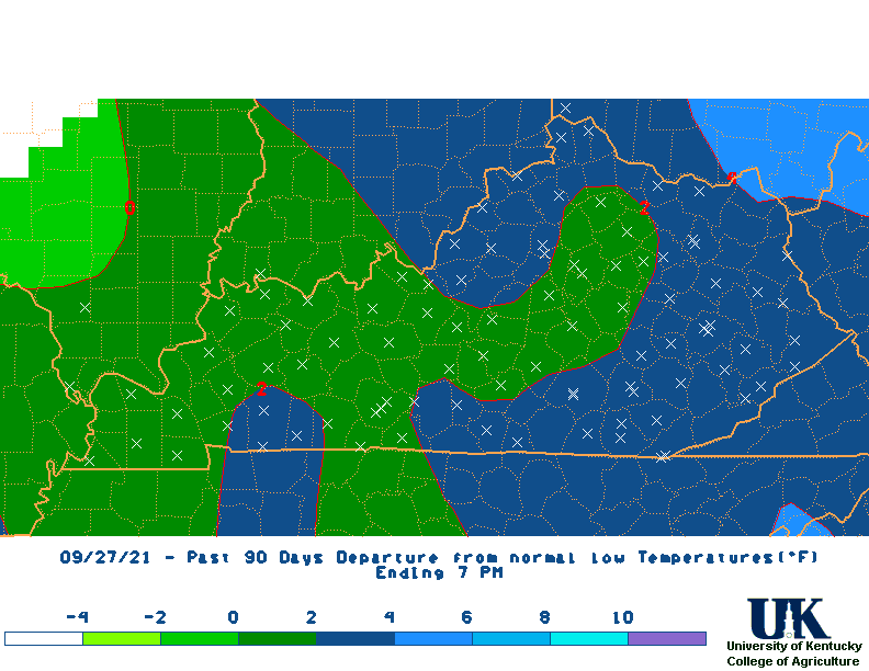
 90 |
 120 |
 180 |
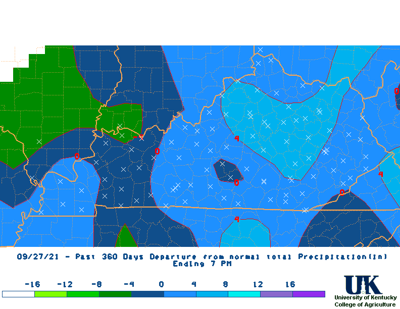 360 |
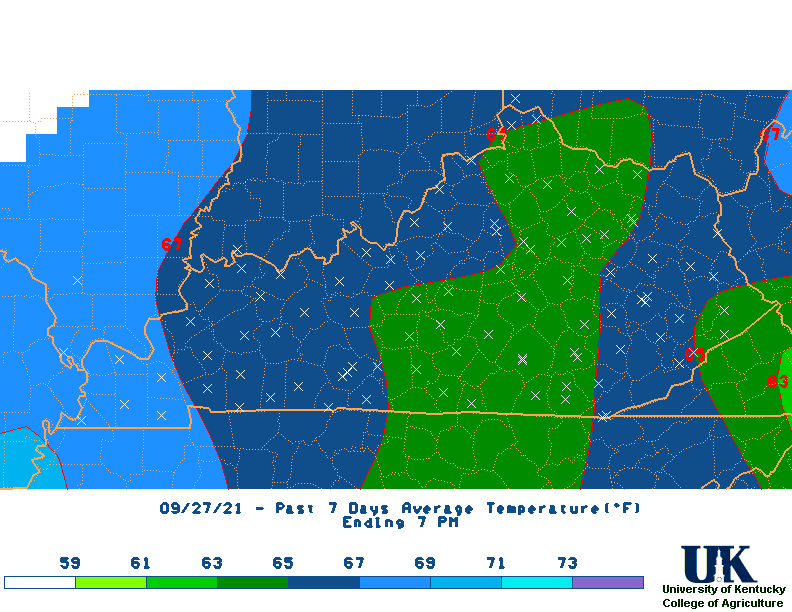
| Average Temperature Maps | 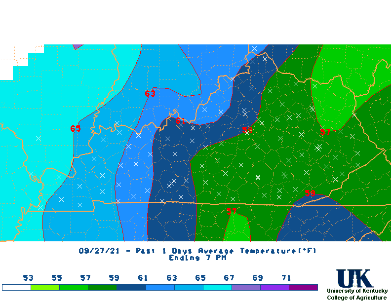 1 Day |
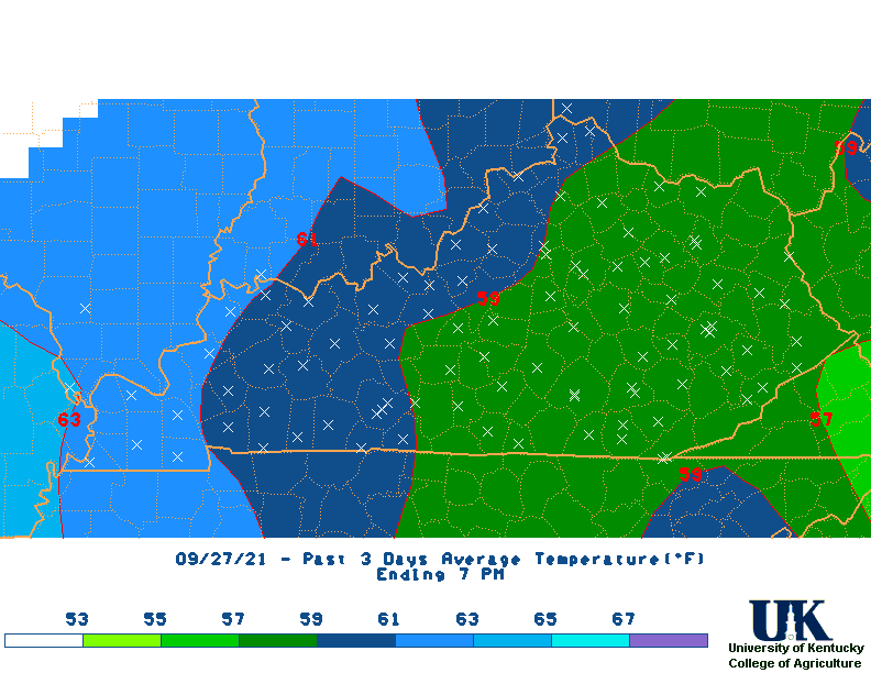 3 |
 7 |
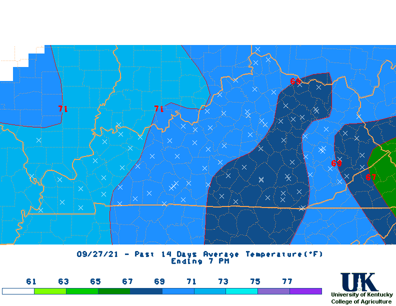 14 |
 21 |
 M2D |
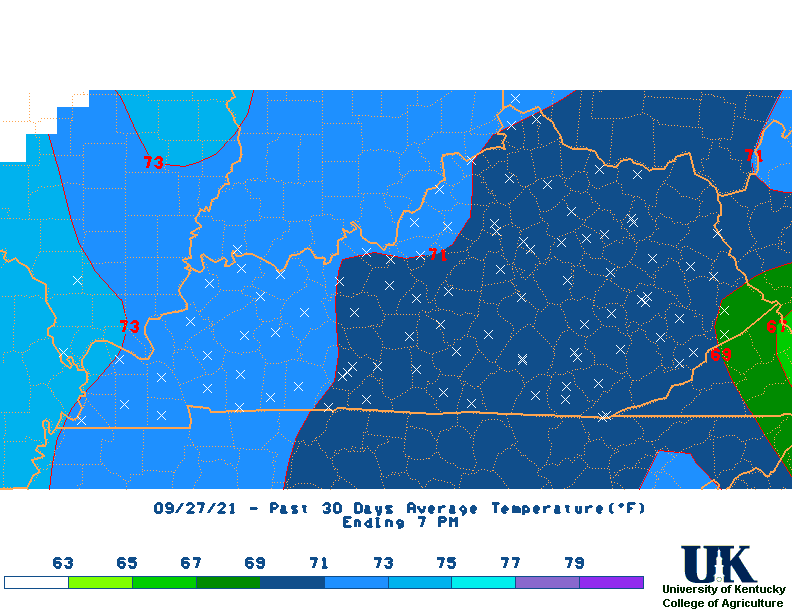 30 |
 60 |
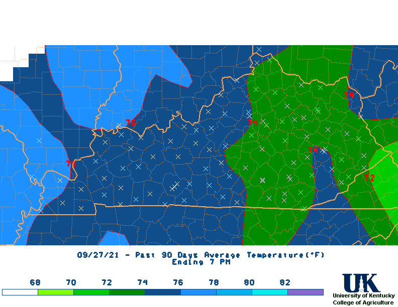 90 |
 120 |
 180 |
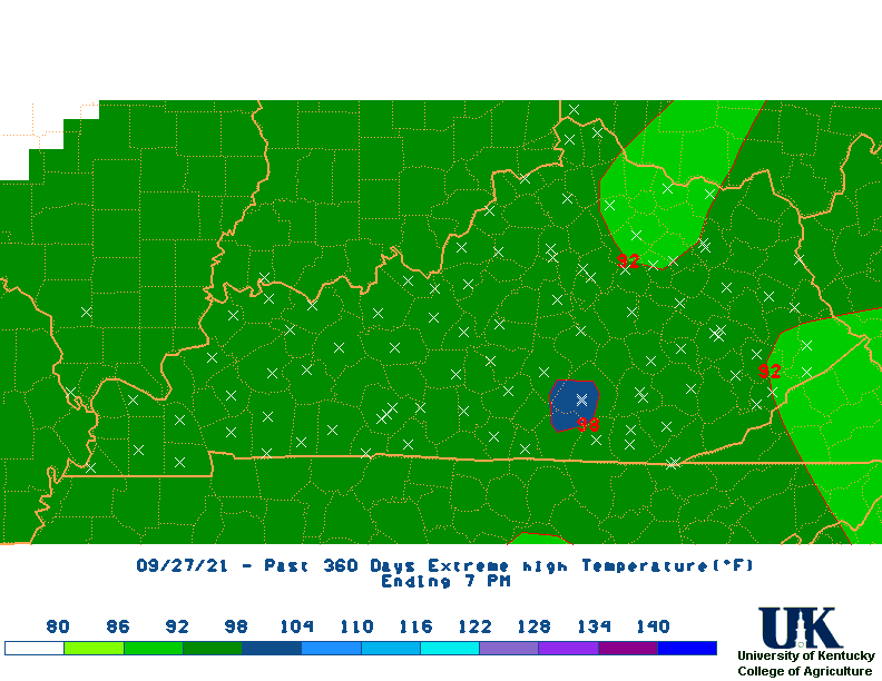
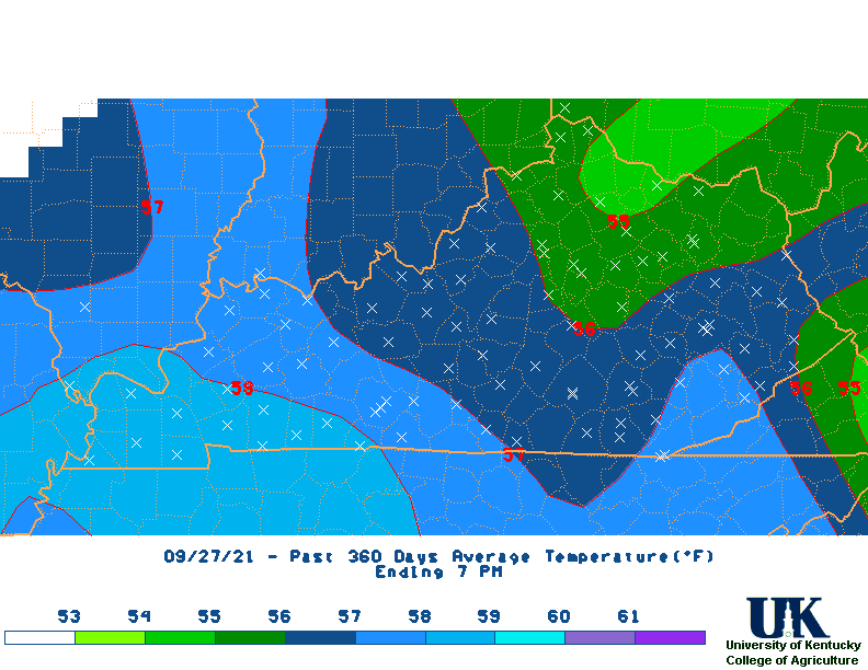 360 |
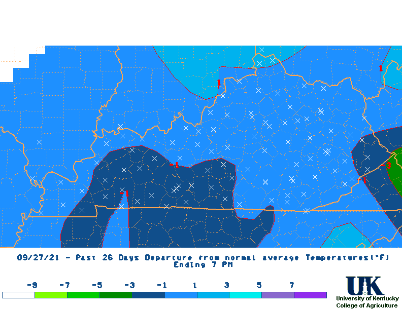
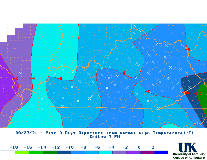
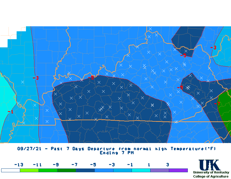
| Average Temperature Departure Maps | 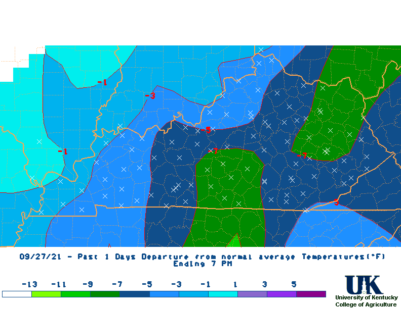 1 Day |
 3 |
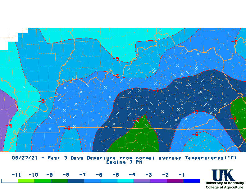
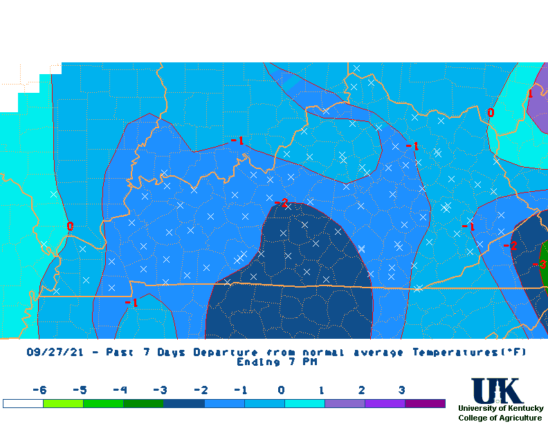 7 |
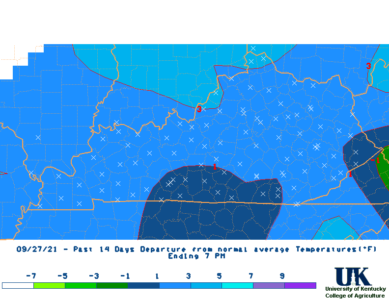 14 |
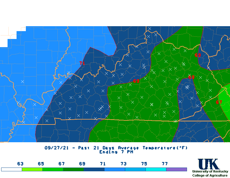
 21 |
 M2D |
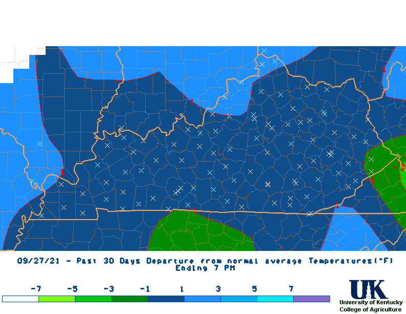 30 |
 60 |
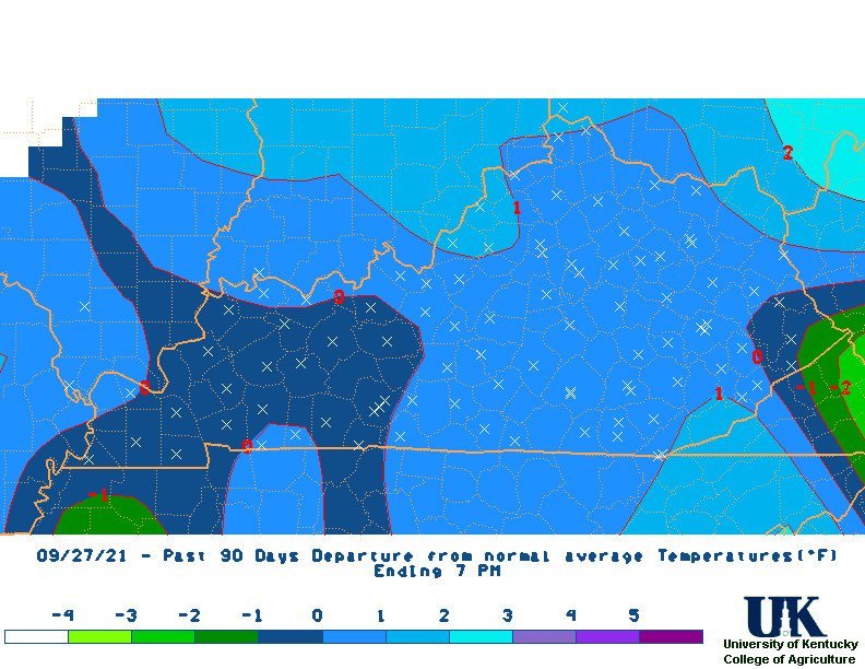 90 |
 120 |
 180 |
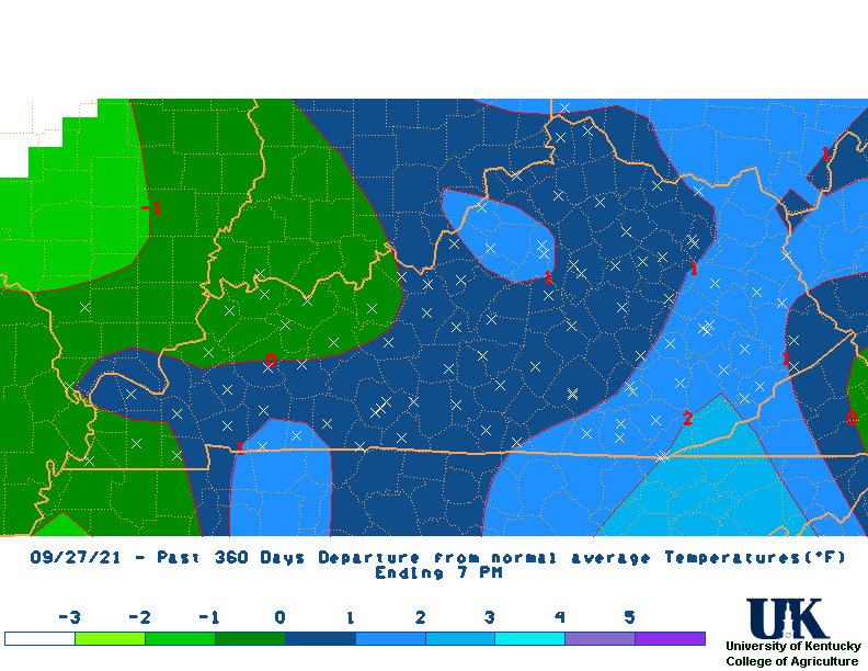 360 |
| Max Temperature Maps |  1 Day |
 3 |
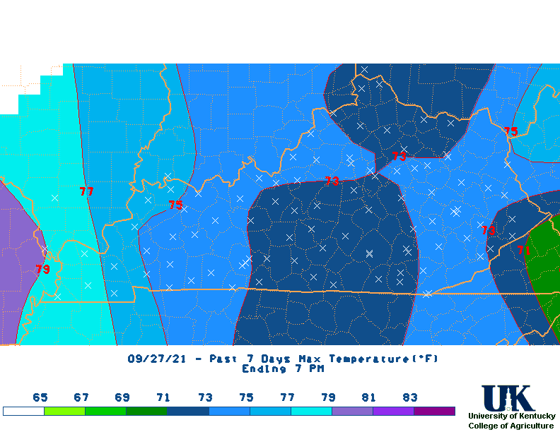 7 |
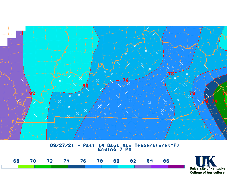 14 |
 21 |
 M2D |
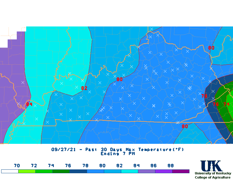 30 |
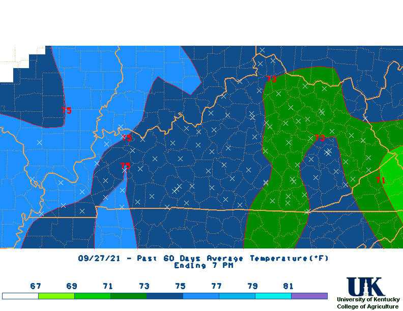
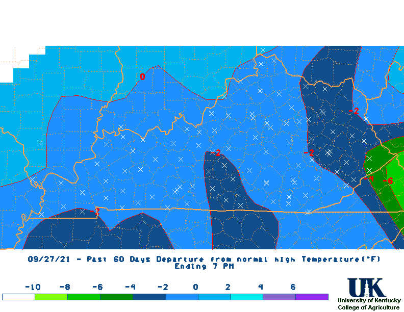
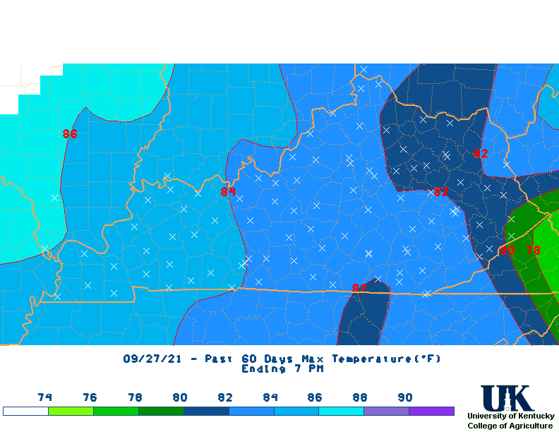 60 |
 90 |
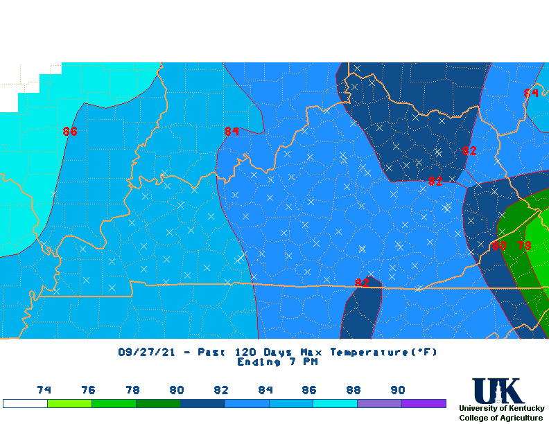 120 |
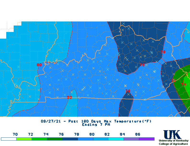 180 |
 360 |
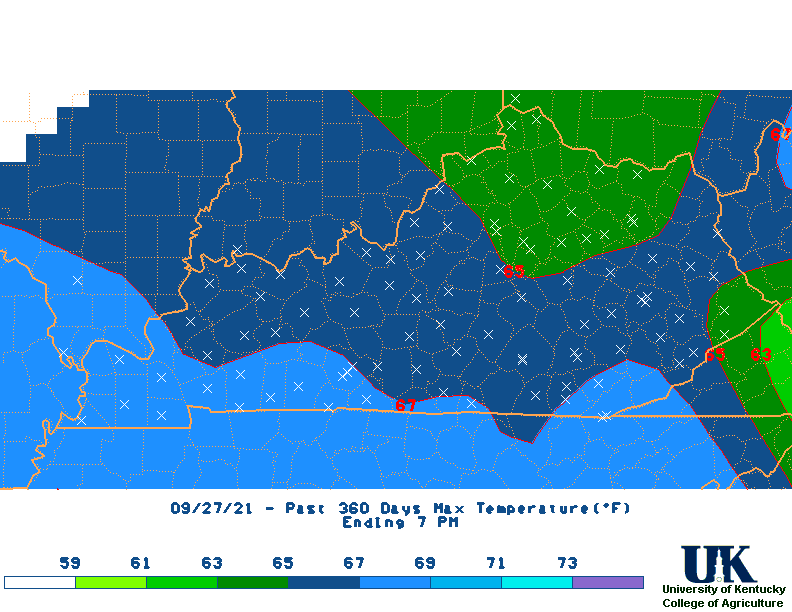
| Max Temperature Departure Maps | 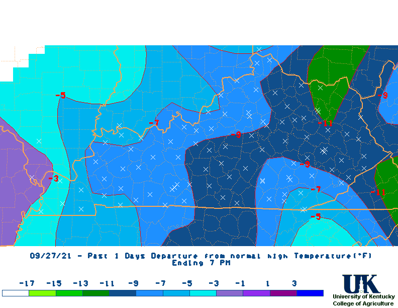 1 Day |
 3 |
 7 |
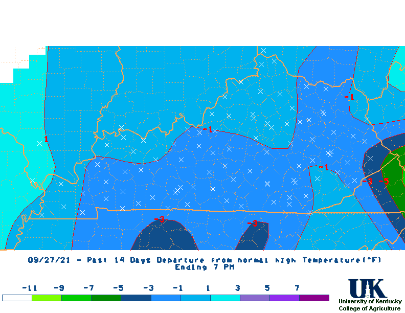 14 |
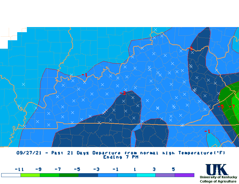 21 |
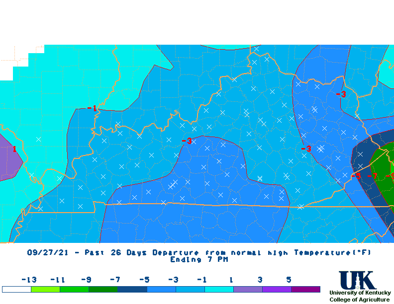 M2D |
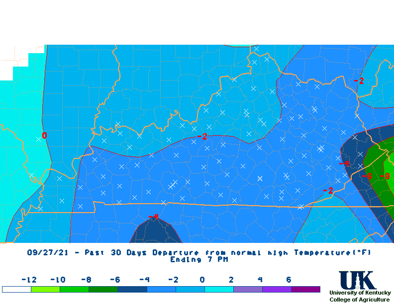 30 |
 60 |
 90 |
 120 |
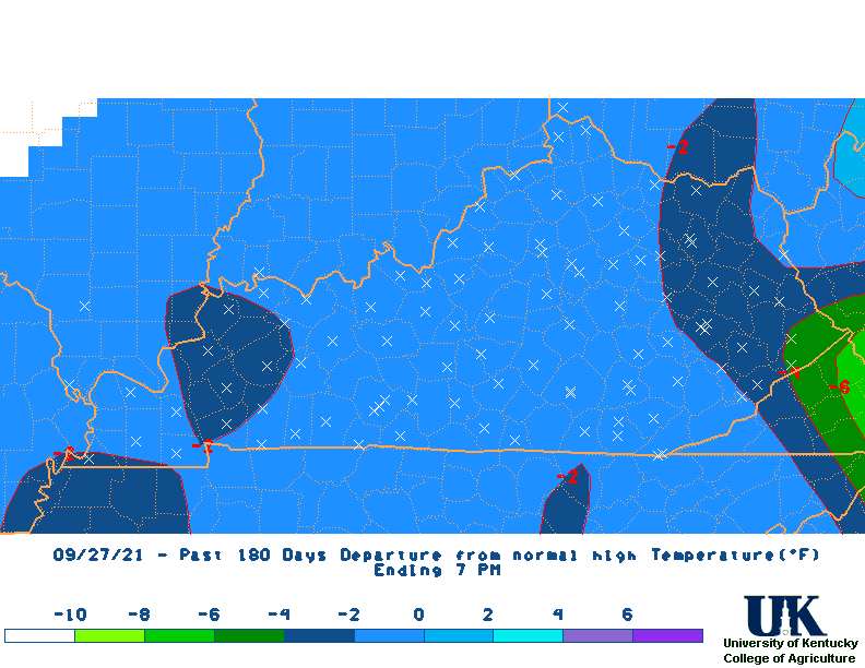 180 |
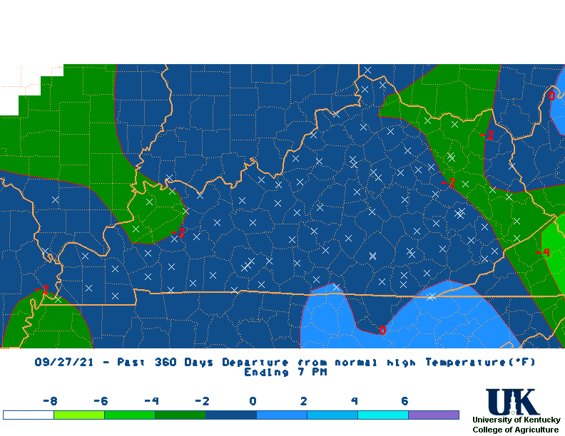 360 |
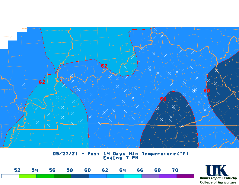
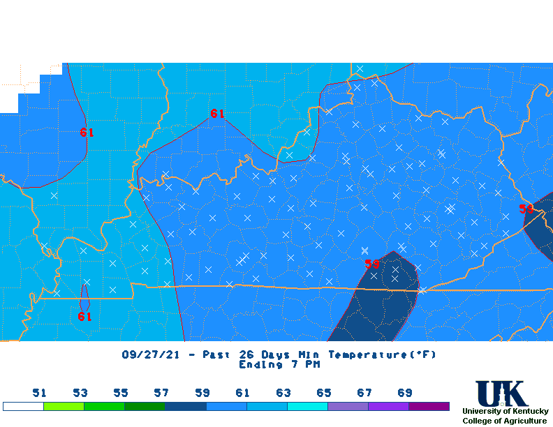
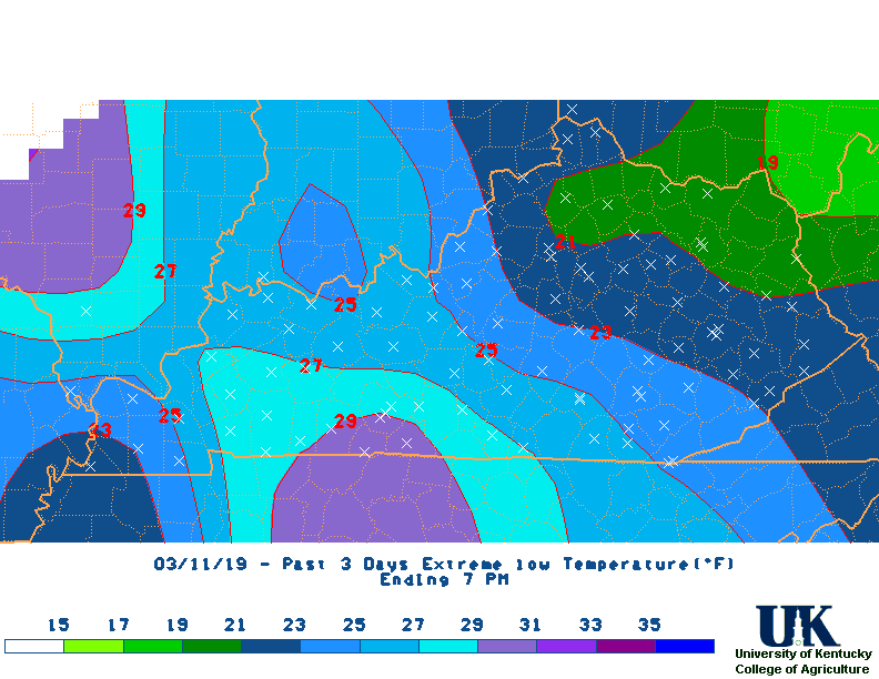
| Min Temperature Maps |  1 Day |
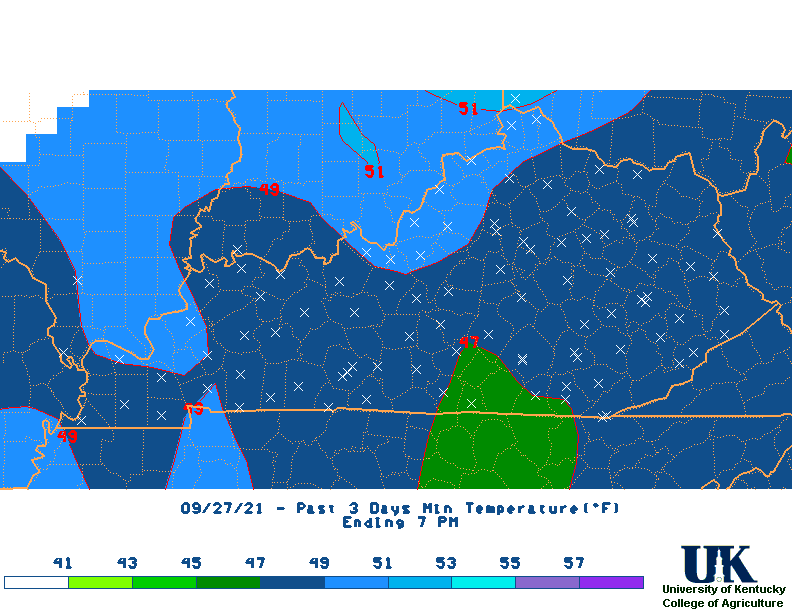 3 |
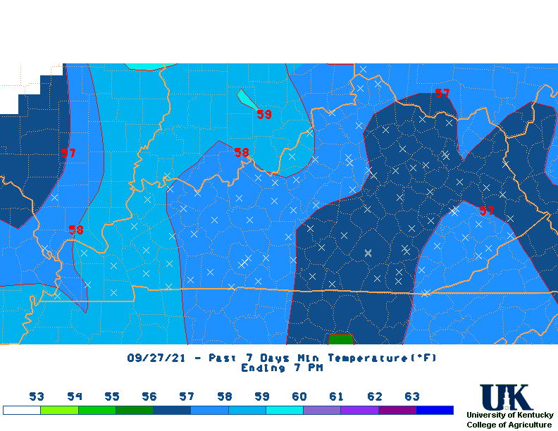 7 |
 14 |
 21 |
 M2D |
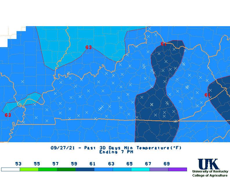 30 |
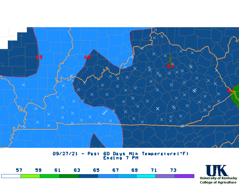 60 |
 90 |
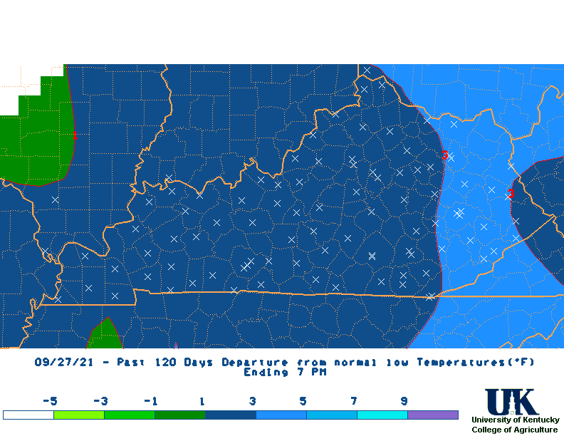
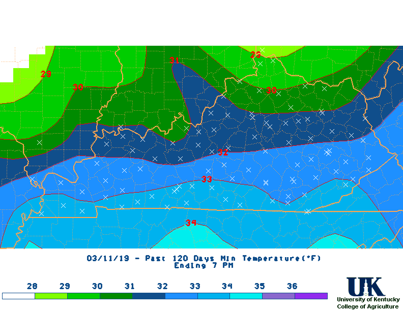 120 |
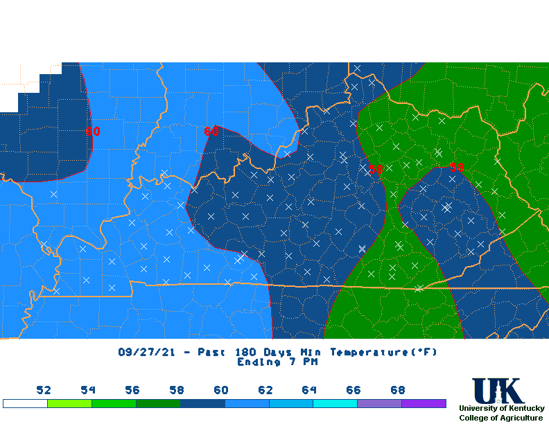 180 |
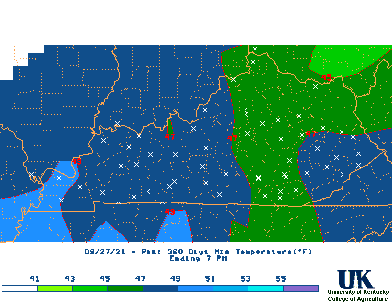 360 |
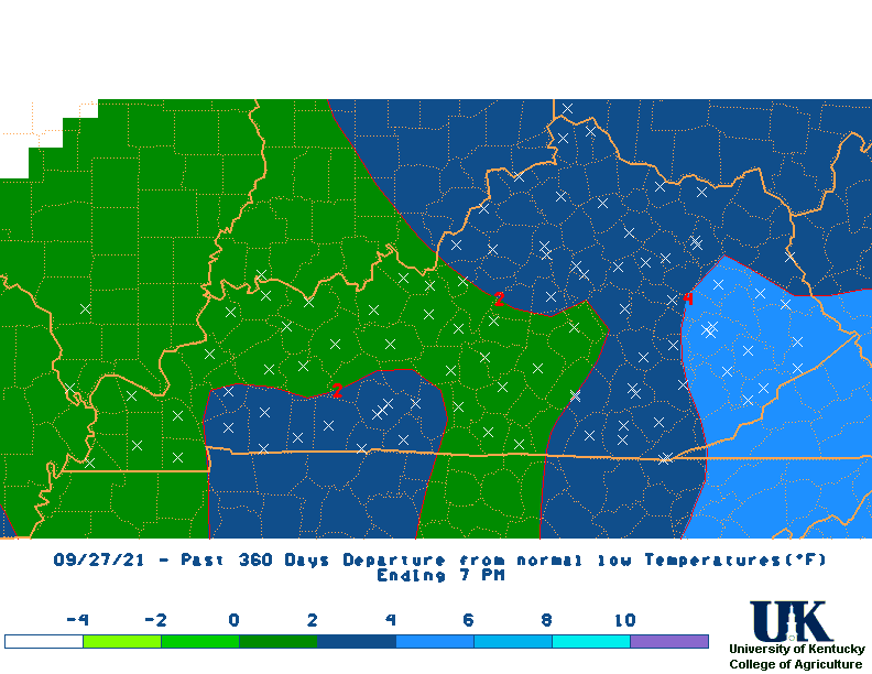
| Min Temperature Departure Maps | 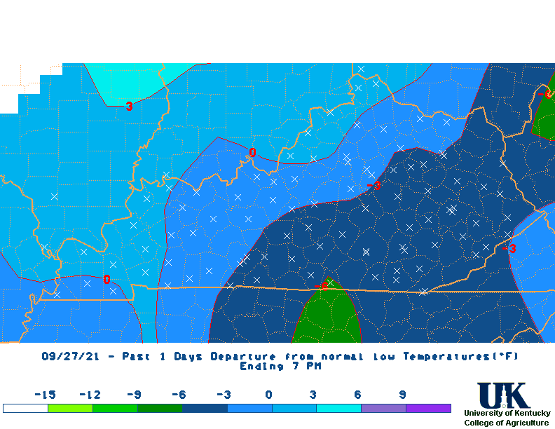 1 Day |
 3 |
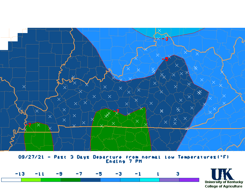
 7 |
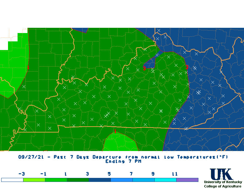
 14 |
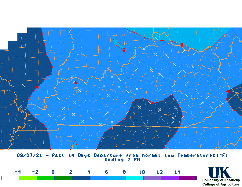
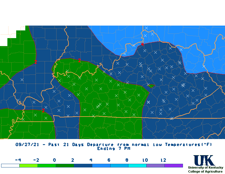 21 |
 M2D |
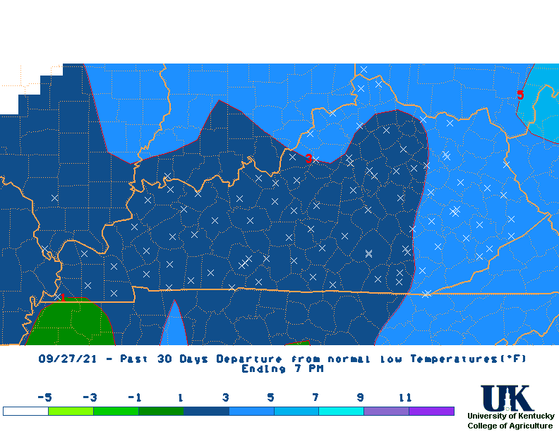 30 |
 60 |
 90 |
 120 |
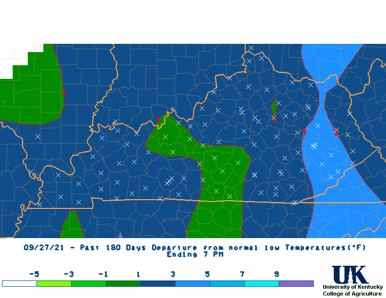 180 |
 360 |
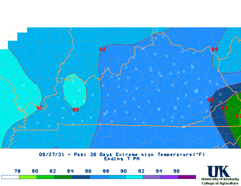
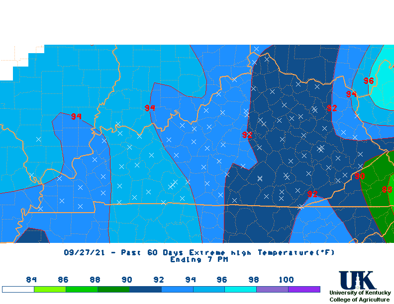
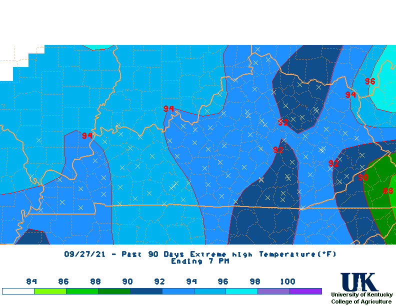
| High Max Temperature Maps | 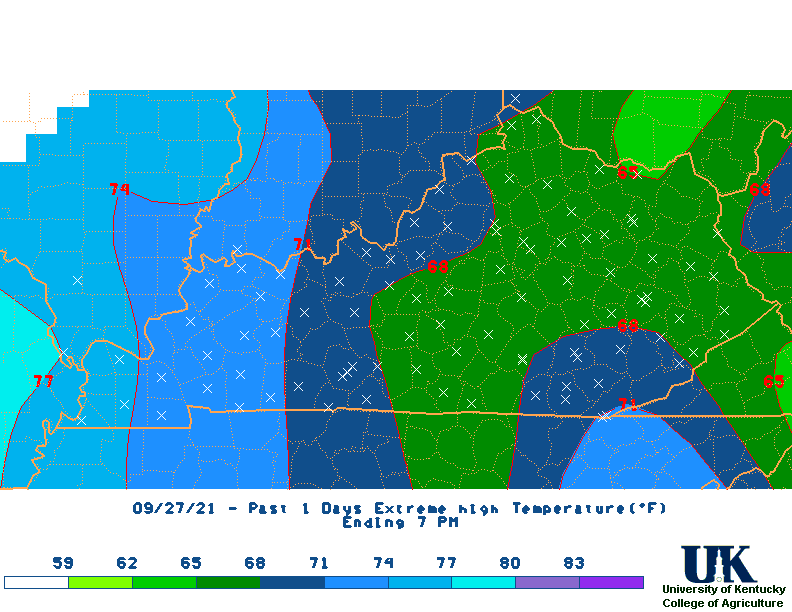 1 Day |
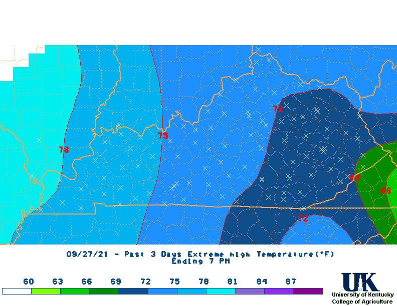 3 |
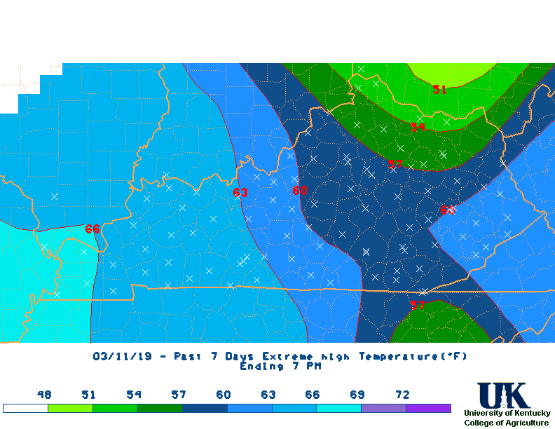 7 |
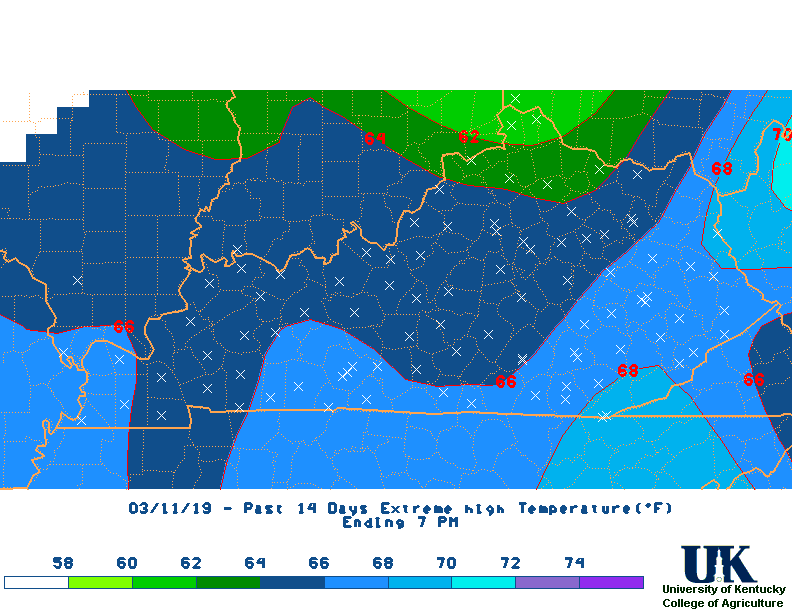 14 |
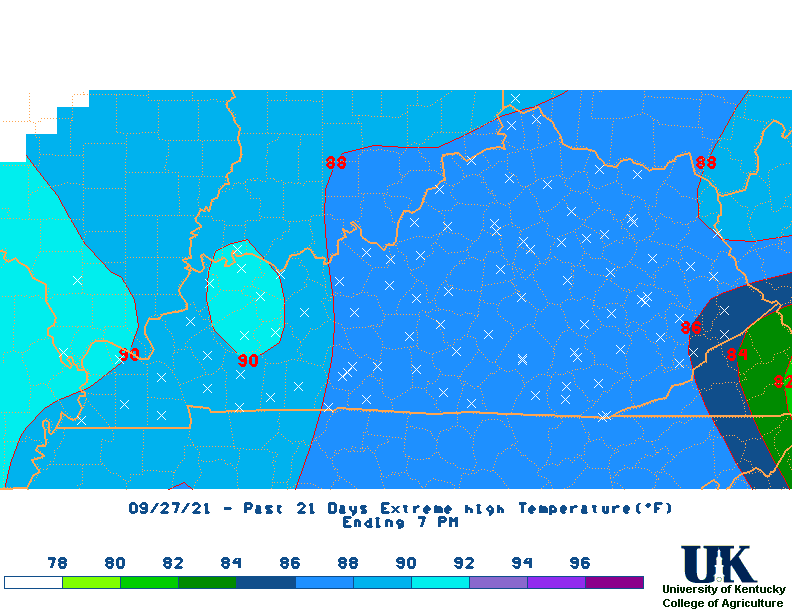 21 |
 M2D |
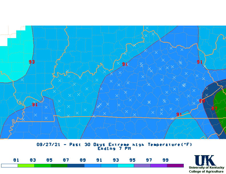 30 |
 60 |
 90 |
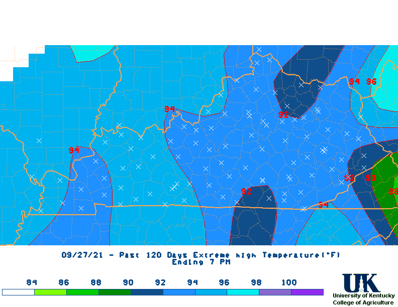 120 |
 180 |
 360 |
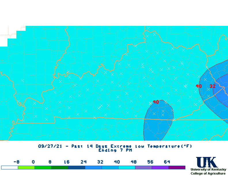
| Low Min Temperature Maps | 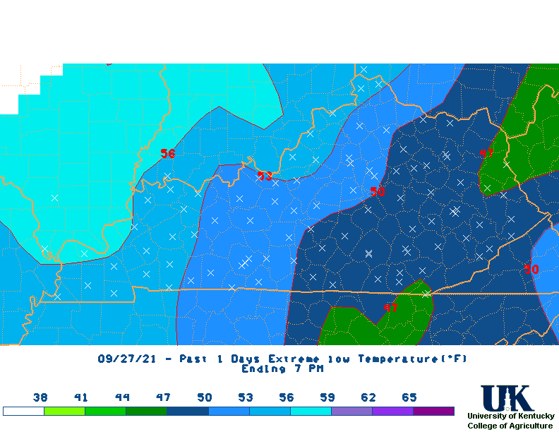 1 Day |
 3 |
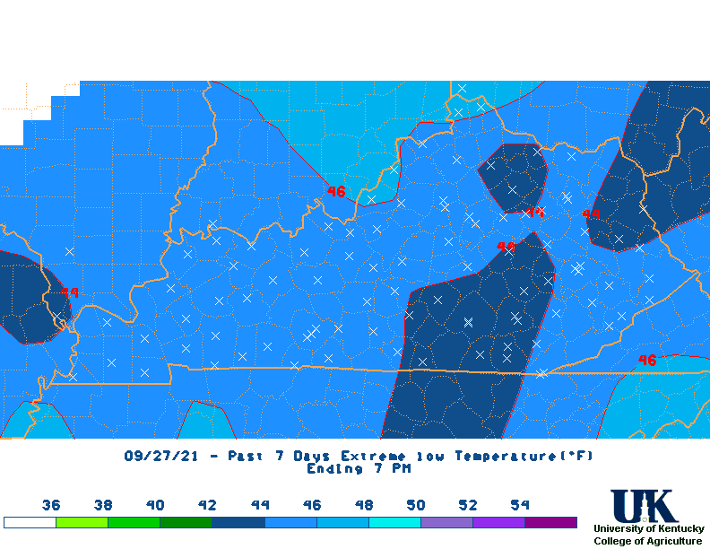 7 |
 14 |
 21 |
 M2D |
 30 |
 60 |
 90 |
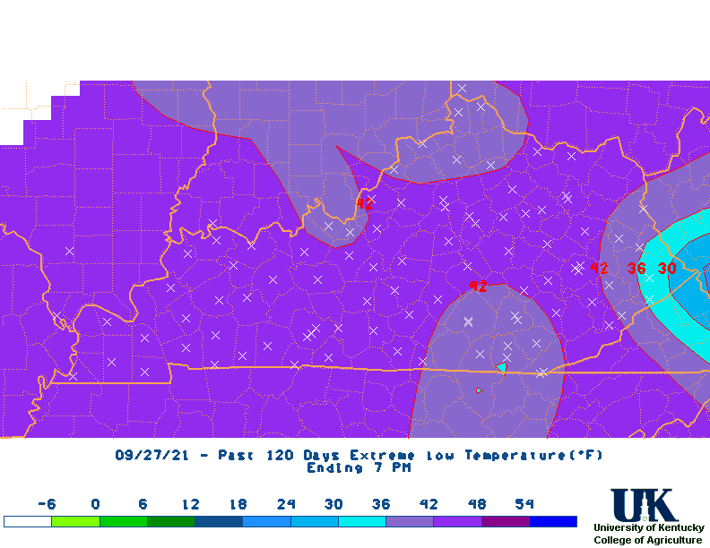 120 |
 180 |
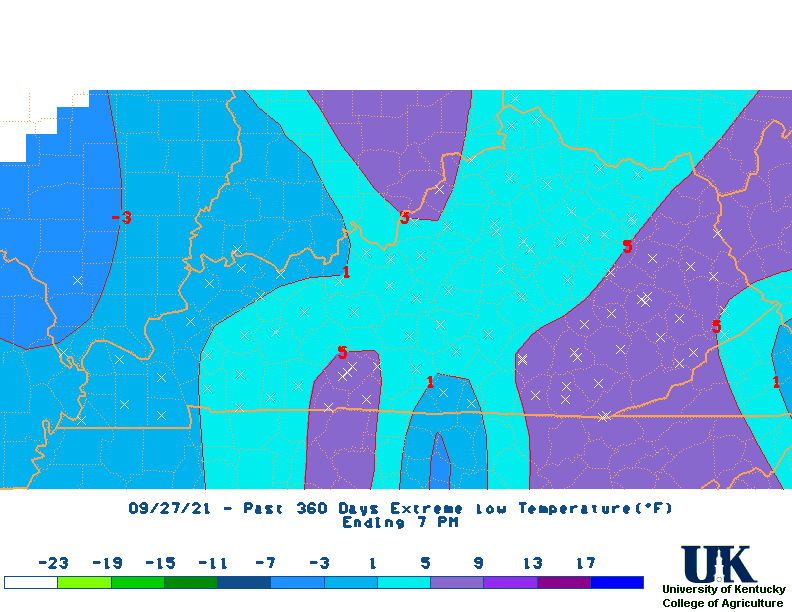 360 |