A joint service of the UK Ag Weather Center and the National Weather Service.
 NWS Weather Discussion
National Ag. Weather Outlook (Repair this link), International Highlights ,International Ag. Weather Summary
Current Surface Map,
[2nd Source TWC]
Click here for UKAWC Point Agricultural, Lawn & Garden Forecast/Outlook in case of corrupt tables.
Regional Hourly Observations For BOONE County
SWR not available
Hourly Obs.,
Current Temperatures,
Dewpoint,
Rh,
Wind,
Regional Obs.,
Station Model,
Surface 4-Panel
Meteograms:
South Bend ,
Fort Wayne ,
Lafayette ,
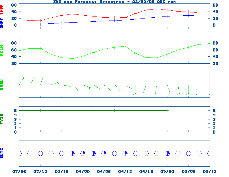
Indianapolis ,
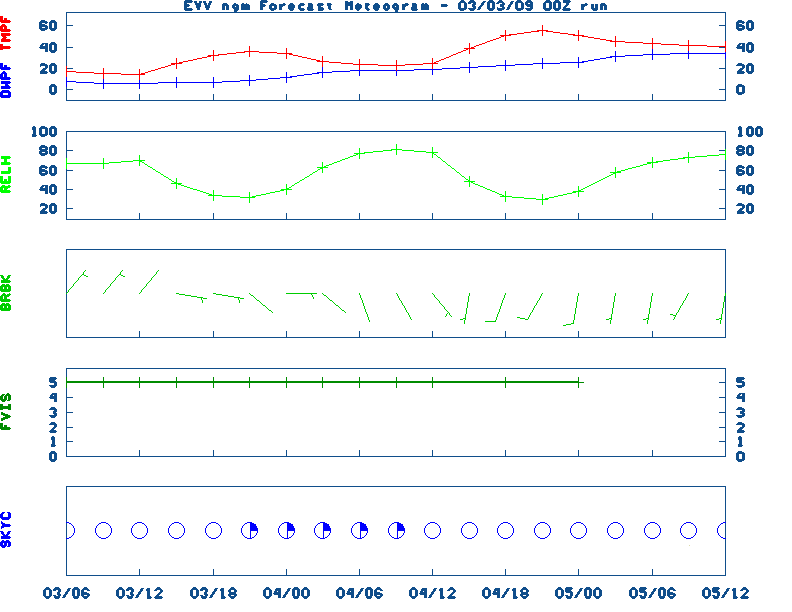
Evansville
Current NOWCAST not available:
Nowcasts are not issued routinely during fair weather. Only when
precipitation or other significant weather is occuring in this county will these
forecasts be issued. Currently, there is no short term forecast in effect.
U.S. Radar,
All NWS Radars (In near-real time),
LSI Heat Index,
Wind Chill Map
Hazardous Weather Outlook For BOONE County
Hazardous report currently not available
NWS Severe Weather Map , Convective Outlook
Current FORECAST not available
12-48 Hr ETA Surface,
12-48 Hr ETA 500mb/Sfc,
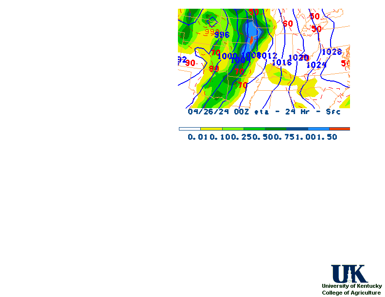
24 Hr. Comparsion,
TWC Forecast,
Fire Danger,
Day 1 Precip,
Day 2 Precip,
Days 1-5 Precip
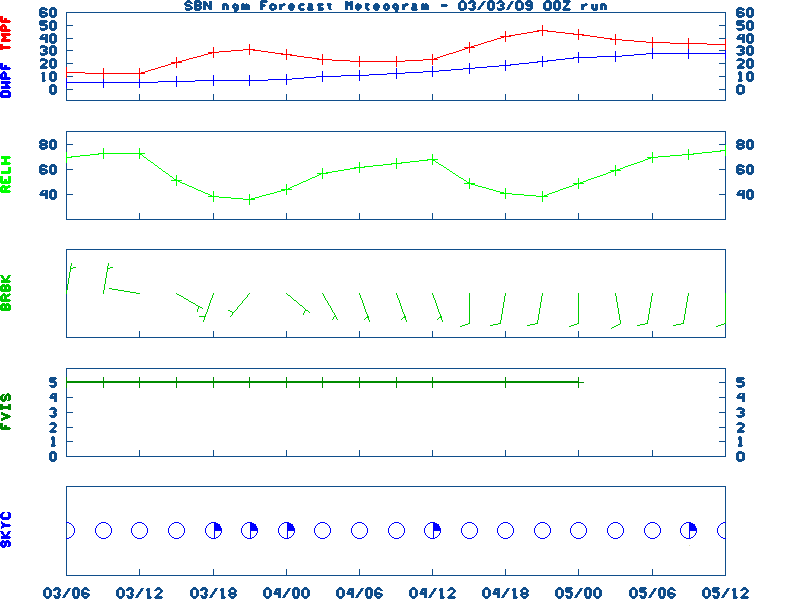
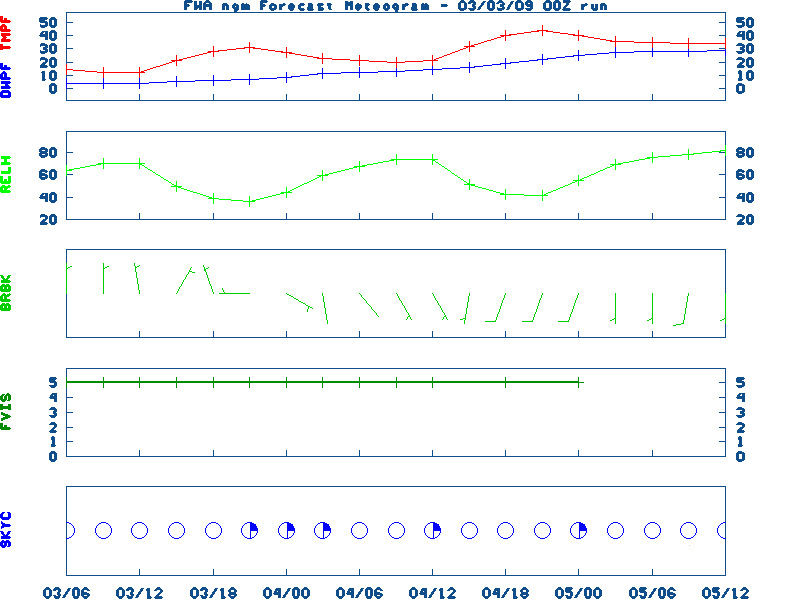
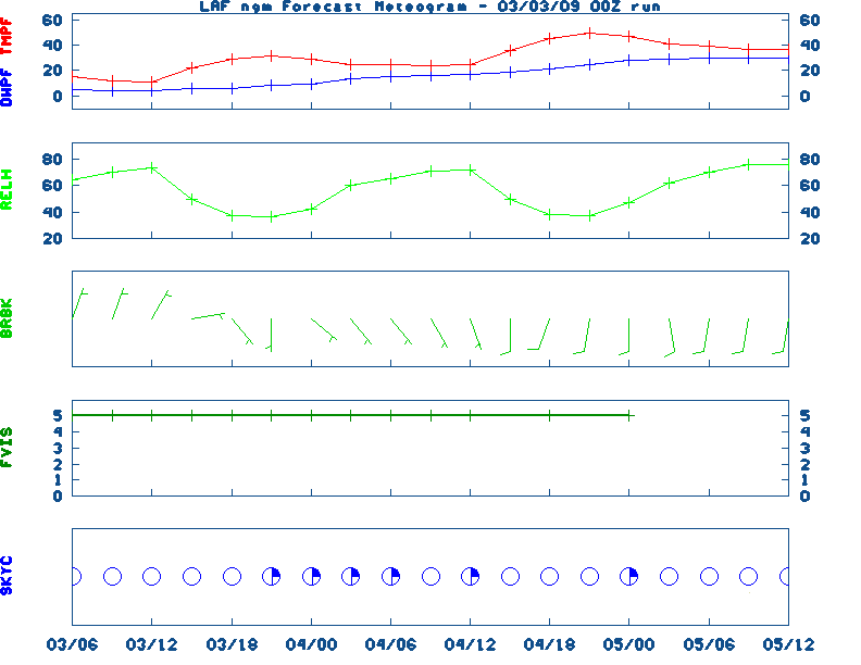
NGM 60 Hr Forecast Meteograms:
South Bend ,
Fort Wayne ,
Lafayette ,
Indianapolis ,
Evansville ,
Severe Weather Pot.-Day 1,
Day 2
The weather OUTLOOK is not available
5 Day Rainfall Total Forecast,
6 to 10 Day ,
8 to 14 Day ,
Text,
30-Day Outook,
90-Day,
120-Day
The ALMANAC file is not available
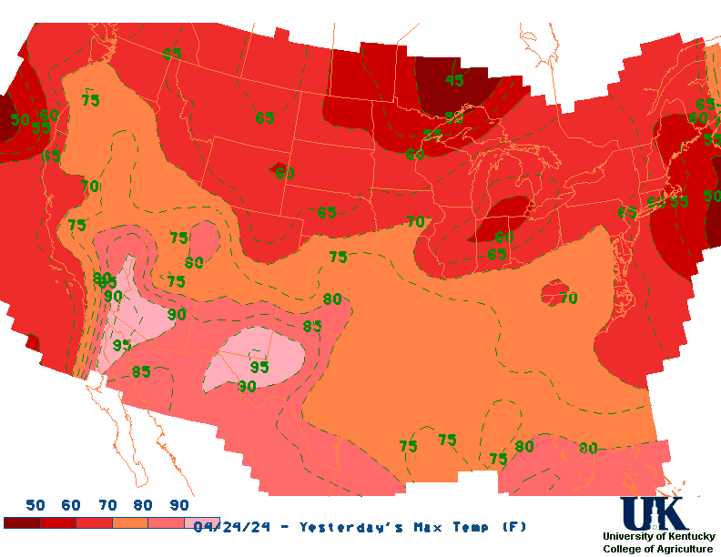
Yesterday's Highs ,
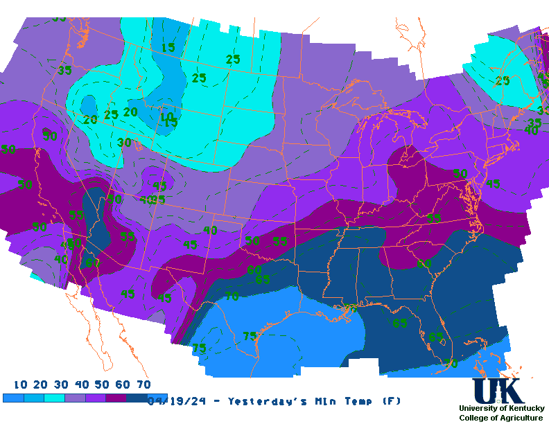
Lows
Sunrise/Sunset/Moonrise/Moonset Computation (USN)
Historical Weather And Climate Facts For Today
The Historical Fact file is not available

Ag Weather Center, Department of Biosystems & Agricultural Engineering, University of Kentucky
|


![[2nd Source TWC]](http://maps.weather.com/images/maps/current/curwx_720x486.jpg)