| ||||||||||||
| ||||||||||||
A joint service of the UK Ag Weather Center and the National Weather Service.
Click here for UKAWC Point Agricultural, Lawn & Garden Forecast/Outlook in case of corrupt tables. Regional Hourly Observations For HENRY County Issued at 800 PM CDT WED APR 24 2024 NORTHWEST ILLINOIS CITY SKY/WX TMP DP RH WIND PRES REMARKS MOLINE CLEAR 51 28 41 E7 30.21F TC 11 STERLING* CLEAR 51 26 37 E6 30.25R TC 11
Current Agricultural Weather Conditions in Illinois Based on observations at 800pm CDT, Wednesday April 24, 2024 Across Illinois...temperatures are near 39 degrees north, near 52 degrees central, and near 58 degrees south. Current sky conditions are partly cloudy north, clear central, and clear south. In the north, relative humidity is near 46%, and the dew point is near 20 degrees. In the central part of the state, relative humidity is near 66%, and the dew point is near 41 degrees. In the south, relative humidity is near 62%, and the dew point is near 45 degrees. Winds are from the northeast at 8 mph north, where conditions are favorable for spraying. The wind chill is near 33 degrees north. Winds are from the east at 7 mph central, where conditions are favorable for spraying. Winds are from the northeast at 6 mph south, where conditions are favorable for spraying. Based on current available observations, the highest temperature is 58 degrees at Mount Vernon and Carbondale. The lowest temperature is 10/ degrees at Northerly Island.
Current NOWCAST not available: Nowcasts are not issued routinely during fair weather. Only when precipitation or other significant weather is occuring in this county will these forecasts be issued. Currently, there is no short term forecast in effect. Hazardous Weather Outlook For HENRY County,IL 735 PM CDT Wed Apr 24 2024 DAY ONE TONIGHT Frost and freezing temperatures will be likely in parts of northwest Illinois later tonight into early Thursday morning. A Freeze Warning and Frost Advisory are in effect for parts of northwest Illinois. Please see the latest statements for more details. DAYS TWO THROUGH SEVEN THURSDAY THROUGH TUESDAY Friday through Sunday, the Storm Prediction Center has a Slight Risk (level 2 of 5) for much of the outlook area during this time-frame. Several rounds of thunderstorms are expected and some storms may produce damaging winds, large hail and very heavy rainfall. A few tornadoes are also possible but timing of this is uncertain. SPOTTER INFORMATION STATEMENT Spotter activation will not be needed tonight.
7-Day Forecast For HENRY County, IL 613 PM CDT Wed Apr 24 2024 TONIGHT THURSDAY THURSDAY NIGHT FRIDAY FRIDAY NIGHT SATURDAY SATURDAY NIGHT SUNDAY AND SUNDAY NIGHT MONDAY MONDAY NIGHT TUESDAY AND TUESDAY NIGHT WEDNESDAY
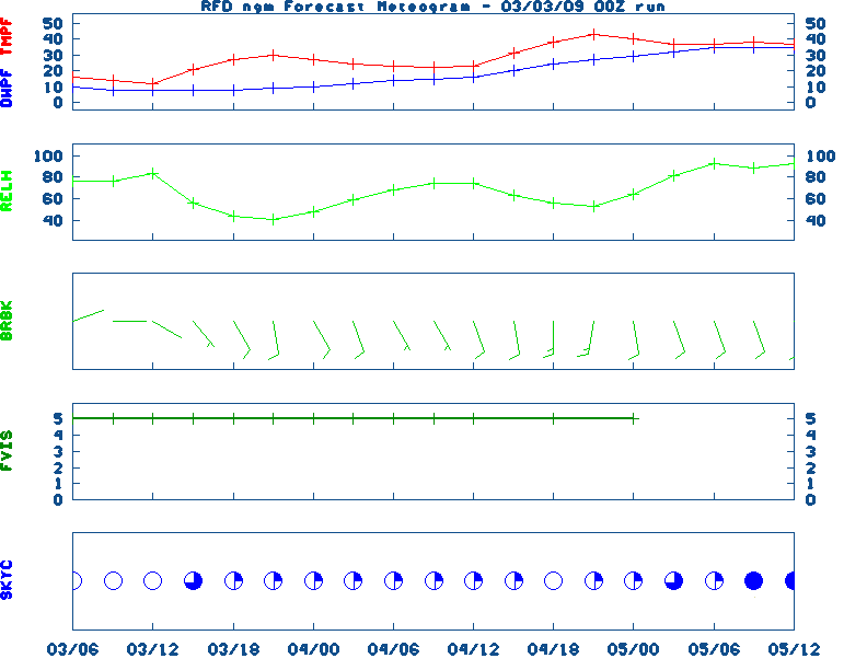
Medium & Long Range Outlook For Illinois
                             ILLINOIS
                 ---------------------------------------------
                 6 TO 10 DAY  8 TO 14 DAY   30 DAY    90 DAY
                APR 30-MAY 4  MAY 2-MAY 8    JUN       JUN-AUG
                 -----------  -----------  --------  ---------
   Temperature:      Above        Above
 Precipitation:     Normal       Normal

....  Medium and long range outlooks provided by NCEP/K. Thomas Priddy
Almanac Information Wednesday April 24, 2024 the 115th Day of Year --------------------------------------------------- SUN Declination 13.370000 Distance 0.999718 AU Rise 07:07 EDT Set 20:48 EDT Transit Meridian 13:56 EDT Civil Twilight Begins 06:39 EDT Ends 21:15 EDT Calculations made for central point in the state. Time in ET -- and will vary due to location and elevation -- Priddy Historical Weather And Climate Facts For Today APRIL 24TH HISTORIC WEATHER EVENTS ...1899... Two women and one son lived to tell the story of being picked up by a tornado and carried more than a fourth of a mile, flying far above the church steeples, before being gently set down again. The young boy and one of the ladies said they had the pleasure of flying alongside a horse. The horse "kicked and struggled" as it flew high above, and was set down unharmed about a mile away. (The Weather Channel) ...1908... Severe thunderstorms spawned eighteen tornadoes over across the Central Gulf Coast States claiming the lives of 310 persons. The state of Mississippi was hardest hit. A tornado near Hattiesburg MS killed 143 persons and caused more than half a million dollars damage. Four violent tornadoes accounted for 279 of the 310 deaths. The deadliest of the four tornadoes swelled to a width of 2.5 miles as it passed near Amite LA. The tornado also leveled most of Purvis MS. (David Ludlum) (The Weather Channel) ...1925... Louisville's and Bowling Green's warmest April temperature: 91 and 96 degrees, respectively. Also, Lexington's earliest 90 degree temperature (90 degrees). (NWS Louisville) ...1980... Three of eight helicopters were damaged in a sandstorm during a failed-attempt to rescue 52 American hostages held in Iran. The hostages were later released on January 20, 1981. ...2005... The latest measurable snowfall on record occurred across parts of Kentucky last year. The snow was the result of cold air and moisture wrapping around an area of low pressure located over the northeast United States. Accumulating snow was mainly confined to the ridgetops and higher elevations of extreme east Kentucky but at least a few flakes were reported just about everywhere. Some amounts reported from across eastern and central Kentucky include...0.6 inches in Booneville...1.0 inch at Jeremiah...1.2 inches at the Jackson Weather Office...1.5 inches at Cumberland...4.0 inches at Lynch...and 5.0 inches at Closplint. (NWS Jackson)
Ag Weather Center, Department of Biosystems & Agricultural Engineering, University of Kentucky | ||||||||||||


![[2nd Source TWC]](http://maps.weather.com/images/maps/current/curwx_720x486.jpg)